Title: The Hidden Cost of Straight Lines: Quantifying Misallocation Risk in Voronoi-based Service Area Models
ArXiv ID: 2512.01795
Date: 2025-12-01
Authors: JA Torrecilla Pineroa, JM Ceballos Martineza, A Cuartero Saezb, P Plaza Caballeroa, A Cruces Lopeza
📝 Abstract
Voronoi tessellations are standard in spatial planning for assigning service areas based on Euclidean proximity, underpinning regulatory frameworks like the proximity principle in waste management. However, in regions with complex topography, Euclidean distance poorly approximates functional accessibility, causing misallocations that undermine efficiency and equity. This paper develops a probabilistic framework to quantify misallocation risk by modeling travel distances as random scaling of Euclidean distances and deriving incorrect assignment probability as a function of local Voronoi geometry. Using plant-municipality observations (n=383) in Extremadura, Spain (41,635 km2), we demonstrate that the Log-Normal distribution provides best relative fit among alternatives (K-S statistic=0.110). Validation reveals 15.4% of municipalities are misallocated, consistent with the theoretical prediction interval (52-65 municipalities at 95% confidence). Our framework achieves 95% agreement with complex spatial models at O(n) complexity. Poor absolute fit of global distributions (p-values<0.01) reflects diverse topography (elevation 200-2,400m), motivating spatial stratification. Sensitivity analysis validates the fitted dispersion parameter (s=0.093) for predicting observed misallocation. We provide a calibration protocol requiring only 30-100 pilot samples per zone, enabling rapid risk assessment without full network analysis. This establishes the first probabilistic framework for Voronoi misallocation risk with practical guidelines emphasizing spatial heterogeneity and context-dependent calibration.
💡 Deep Analysis
📄 Full Content
The Hidden Cost of Straight Lines: Quantifying Misallocation Risk in Voronoi-Based
Service Area Models
JA Torrecilla Pineroa,∗, JM Ceballos Martineza, A Cuartero Saezb, P Plaza Caballeroa, A Cruces Lopeza
aDepartment of Construction, Universidad de Extremadura, Av. de Elvas s/n, 06006 Badajoz, Spain
bDepartment of Graphical Expression, Universidad de Extremadura, Av. de Elvas s/n, 06006 Badajoz, Spain
Abstract
Voronoi tessellations are a standard tool in spatial planning for assigning service areas based on Euclidean proximity. This
approach underpins key regulatory frameworks, such as the proximity principle in waste management [1, 2]. However, in
regions with complex topography or sparse infrastructure, Euclidean distance is a poor proxy for functional accessibility,
leading to service area misallocations that undermine cost-efficiency and equity. This paper develops a probabilistic
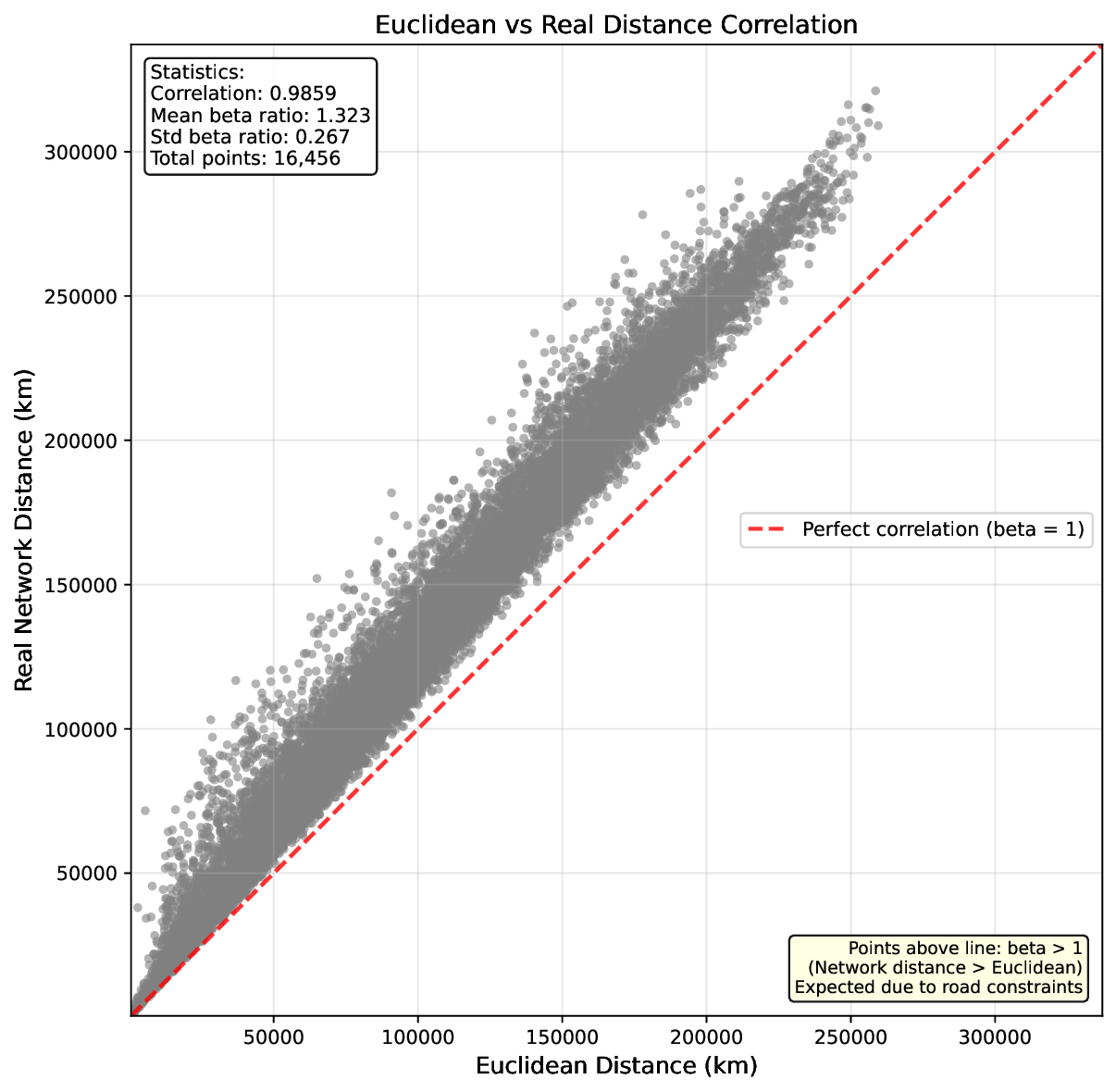
framework to quantify this misallocation risk. We model real travel distances as a random scaling of Euclidean distances
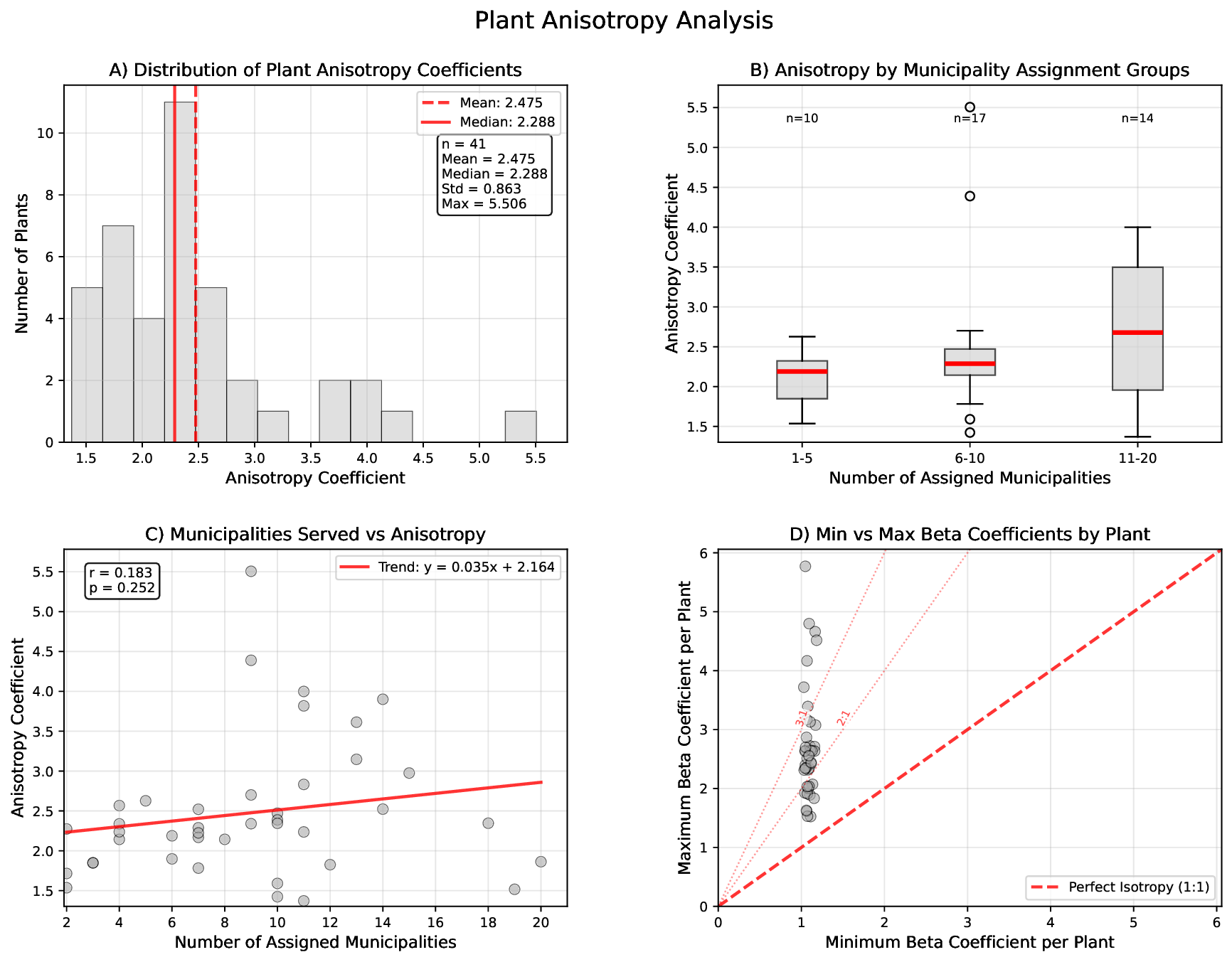
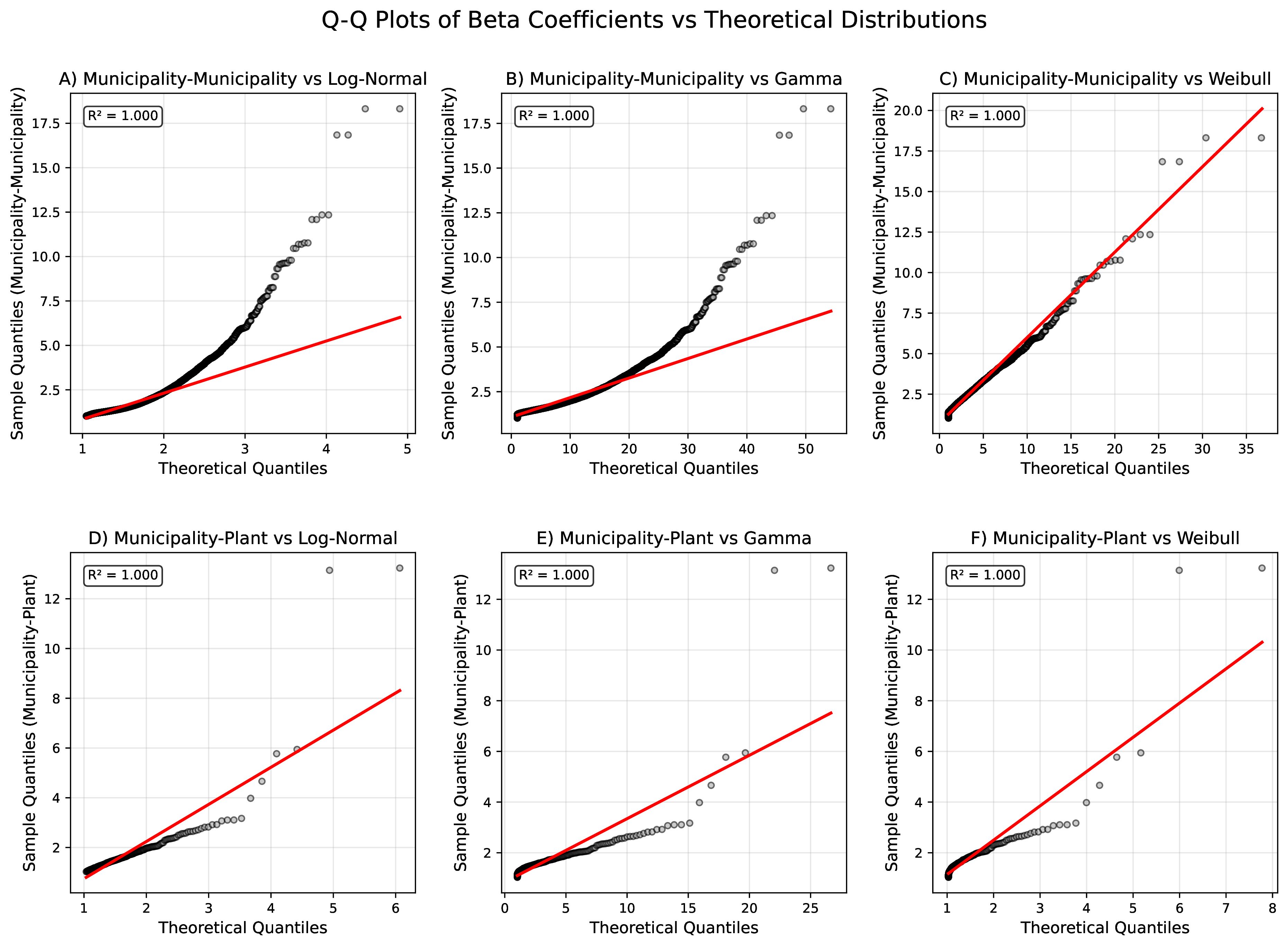
and derive the probability of incorrect assignment as a function of local Voronoi geometry. Using statistically independent
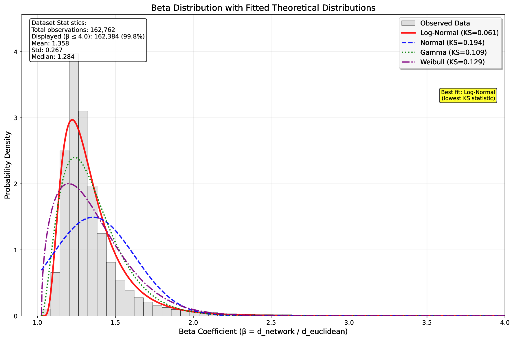
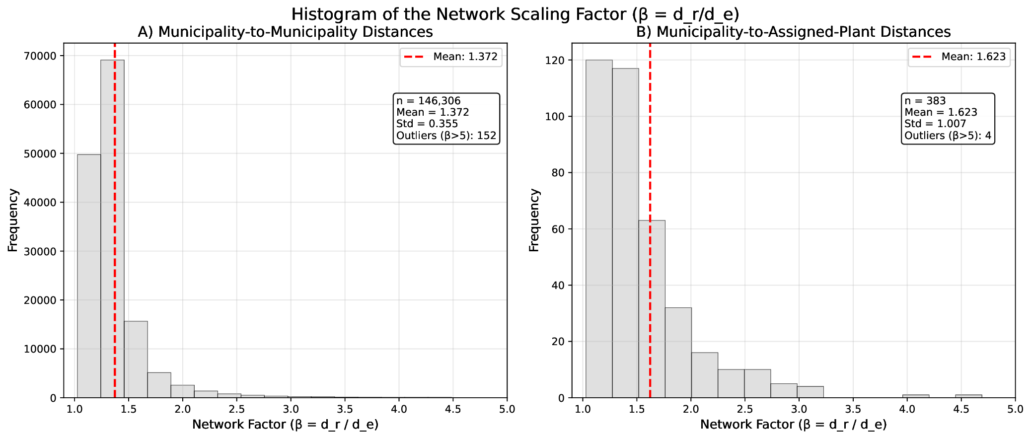
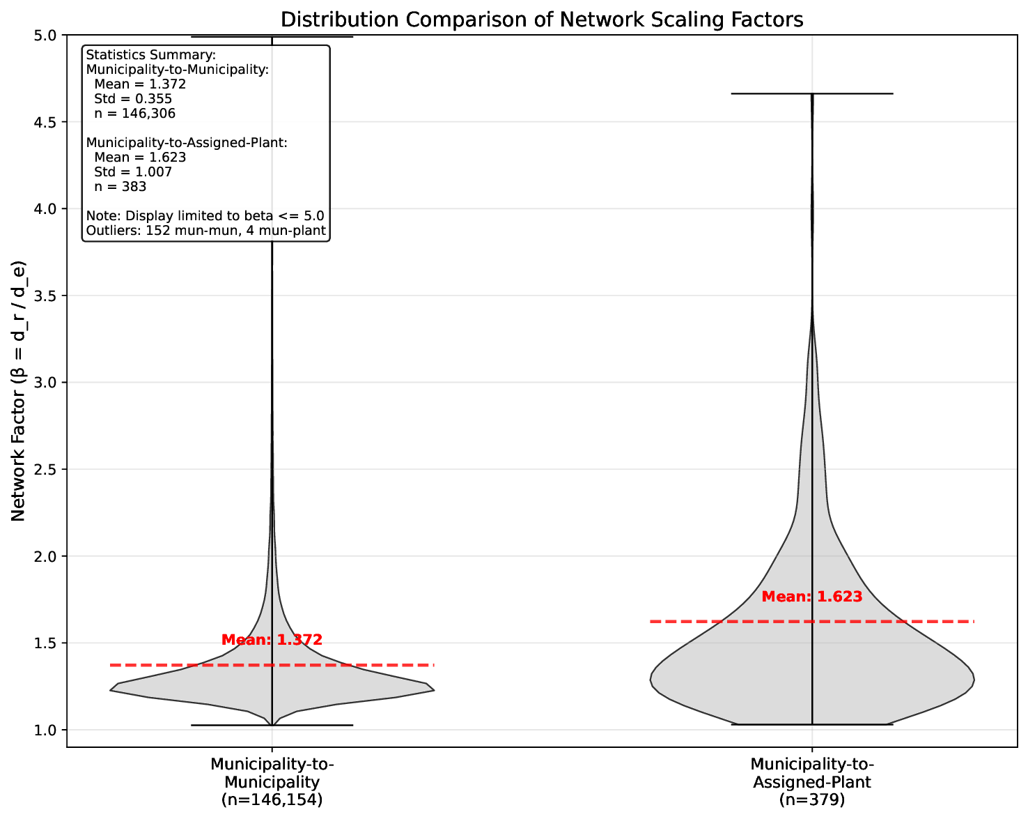
plant-municipality observations (n=383), we demonstrate that the Log-Normal distribution provides best relative fit
among tested alternatives (K-S statistic = 0.110) despite substantial spatial heterogeneity in Extremadura territory
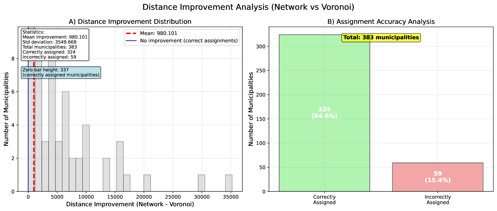
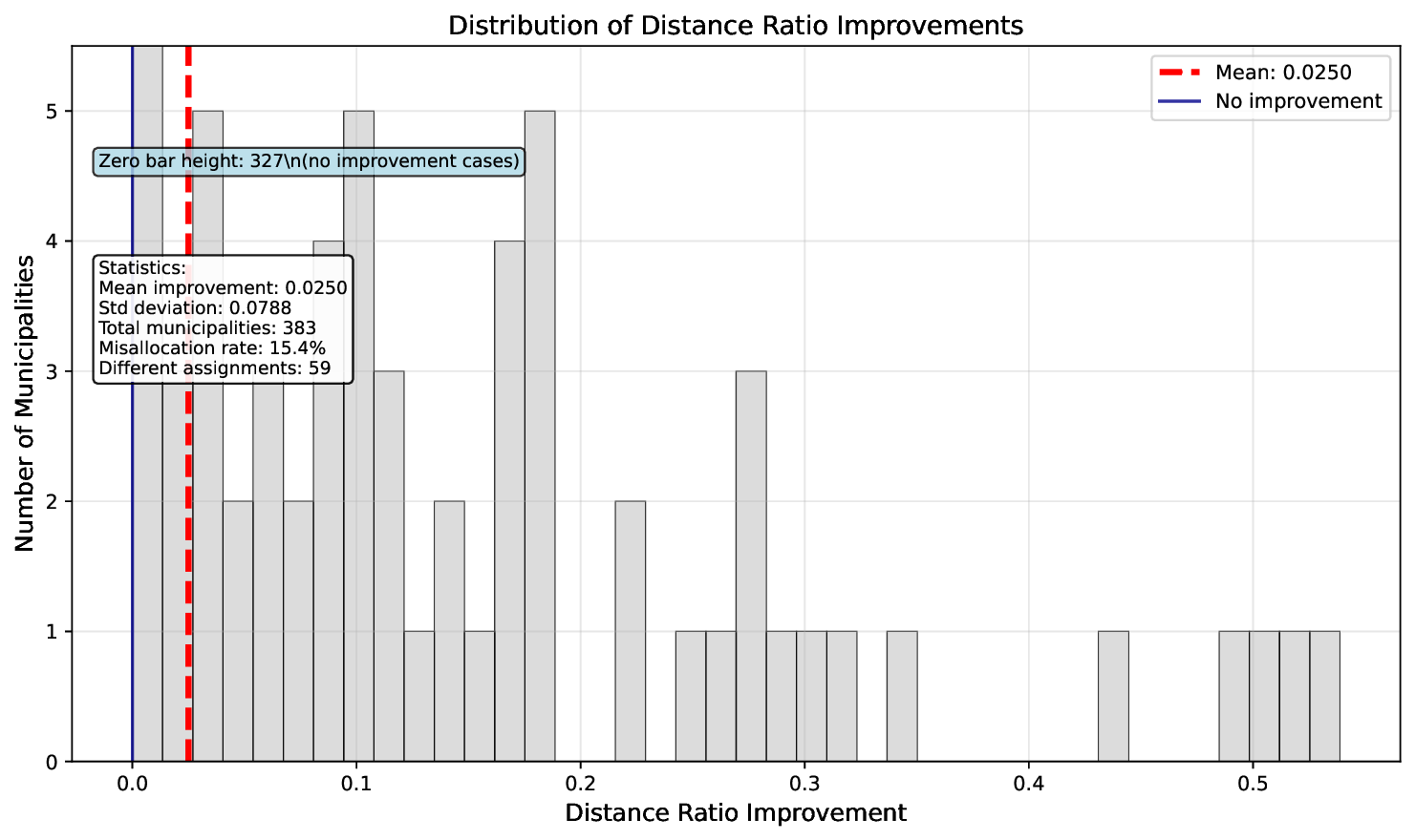
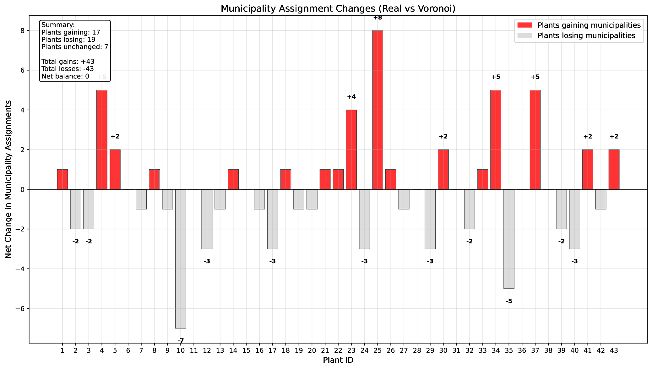
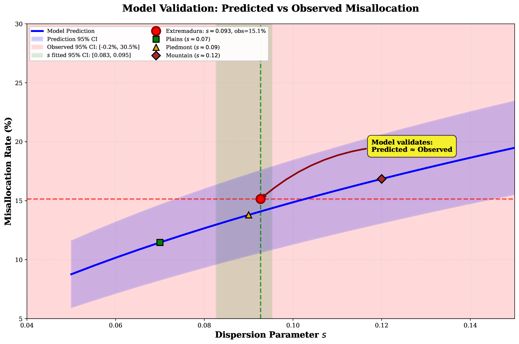
(41,635 km2). Validation reveals that 15.4% of municipalities are functionally misallocated by the Euclidean model,
consistent with the theoretical prediction interval (52–65 municipalities at 95% confidence). Our framework predicts this
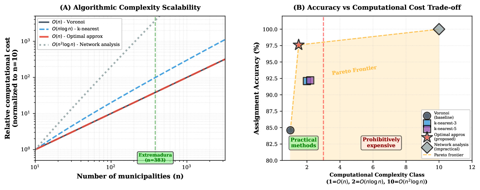
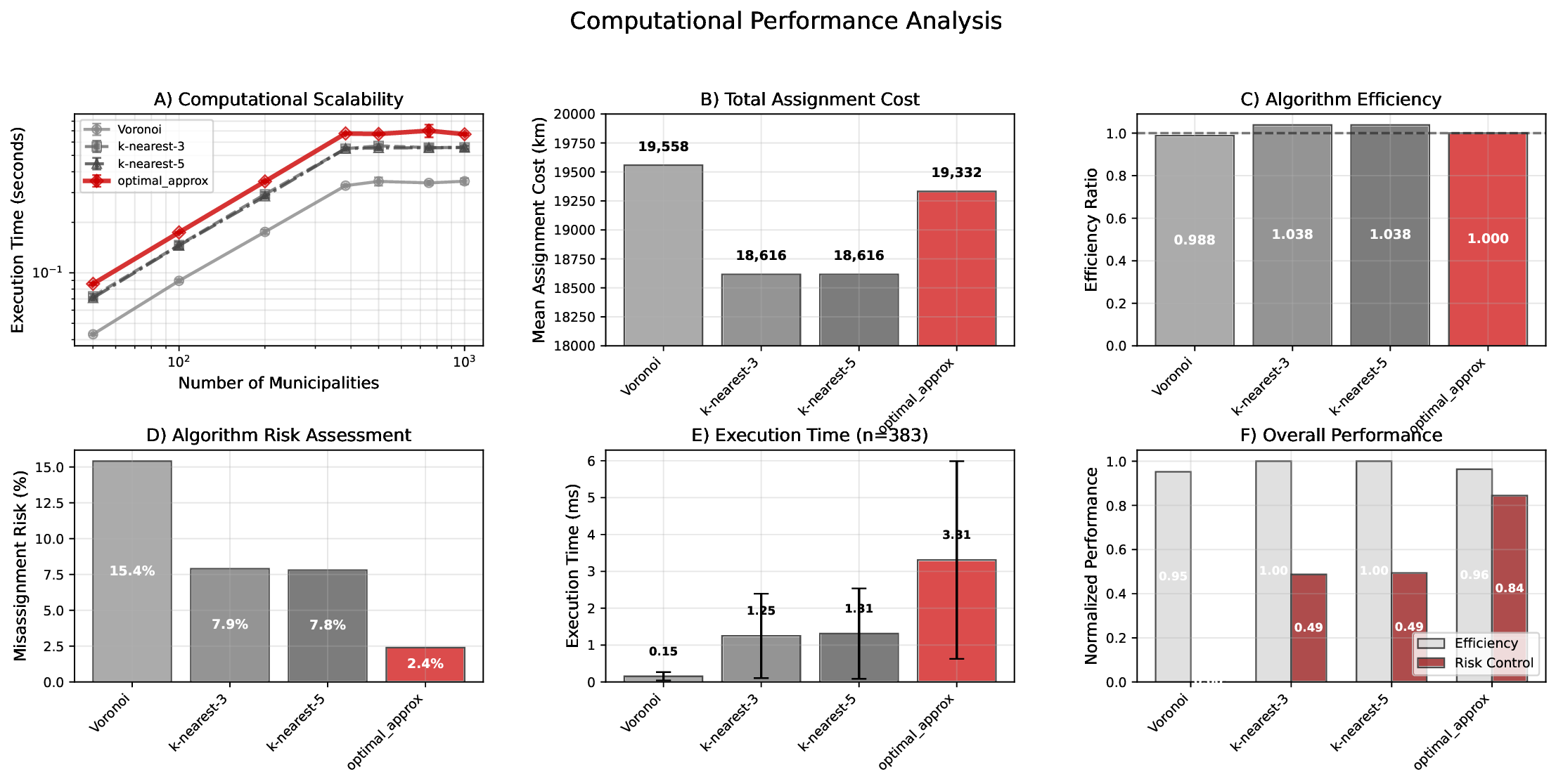
risk with 95% agreement to complex spatial models but with O(n) complexity, avoiding costly network analyses. Critically,
poor absolute fit of global distributions (all p-values < 0.01) reflects the territory’s diverse topography (elevation range
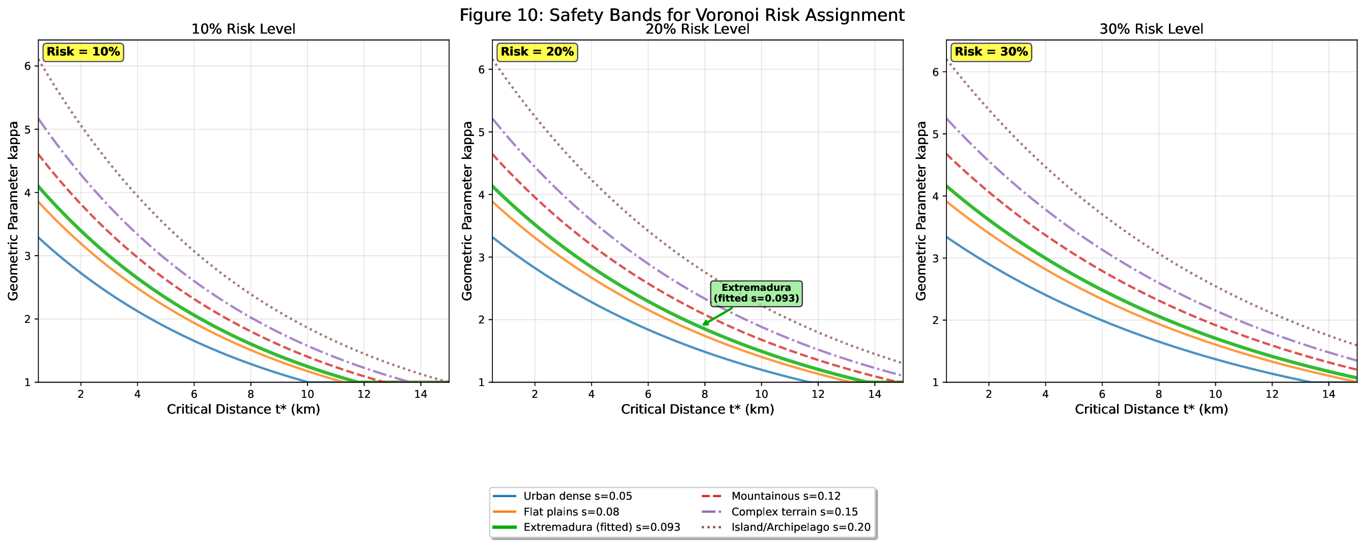
200–2,400m), motivating spatial stratification. Sensitivity analysis demonstrates that the fitted dispersion parameter
(s = 0.093) accurately predicts observed misallocation, while internal stratification by topographic zones explains local
variations. We provide a systematic calibration protocol requiring only 30–100 pilot samples per zone, enabling rapid risk
assessment without full network analysis. This work establishes the first probabilistic framework for Voronoi misallocation
risk, with practical guidelines emphasizing spatial heterogeneity and context-dependent calibration.
Keywords: Voronoi tessellation, Probabilistic risk assessment, Spatial misallocation, Network distance, Waste
management planning, Calibration protocol
1. Introduction
The Voronoi tessellation is a cornerstone of computa-
tional geometry and spatial analysis, offering an elegant
solution to the nearest facility problem [3]. Its widespread
adoption in urban planning, logistics, and environmental
management, however, rests on a powerful yet often flawed
assumption: that Euclidean distance is a reliable proxy for
functional accessibility. This principle of geometric prox-
imity is embedded in regulatory frameworks like the EU’s
proximity principle for waste management, which assumes
that geographic nearness ensures cost-effectiveness and min-
imal environmental impact [4]. This paper challenges that
assumption. We began with a simple question during a
study of waste management in Extremadura, Spain: Is the
closest plant really the closest? When we compared the offi-
cial Voronoi-based allocation of municipalities to treatment
plants with allocations based on actual road network dis-
tances, a striking anomaly emerged: a significant number of
municipalities were functionally closer to a different plant.
∗Corresponding author:
This discrepancy was not random but spatially clustered
in areas with complex topography, suggesting a systemic
failure of the model.
This observation motivates the central question of our
work: if the Euclidean Voronoi model is unreliable in non-
isotropic territories, can we quantify its risk of misallocation
in a generalizable way? Our central contribution is the de-
velopment of a probabilistic framework for quantifying this
misallocation risk, which, to our knowledge and based on
our extensive literature review, has not been previously
addressed in the existing literature. This framework trans-
forms the Voronoi diagram from an operational mandate
into a theoretical benchmark whose deviations can be sys-
tematically predicted and managed. The framework models
the mismatch between Euclidean and network-based dis-
tances through a log-normal scaling factor, enabling plan-
ners to assess risk before committing to costly network
analyses. Our contribution is threefold:
1. An empirical demonstration of the limitations of Eu-
clidean proximity in a real-world case study, showing
that 15.4% of municipalities are misallocated.
Preprint submitted to Elsevier
December 2, 2025
arXiv:2512.01795v1 [physics.soc-ph] 1 Dec 2025
2. A theoretical framework that quantifies the probabil-
ity of misal