Precipitation nowcasting, key for early warning of disasters, currently relies on computationally expensive and restrictive methods that limit access to many countries. To overcome this challenge, we propose precipitation nowcasting using satellite imagery with physics constraints for improved accuracy and physical consistency. We use a novel physics-informed dual neural operator (PIANO) structure to enforce the fundamental equation of advection-diffusion during training to predict satellite imagery using a PINN loss. Then, we use a generative model to convert satellite images to radar images, which are used for precipitation nowcasting. Compared to baseline models, our proposed model shows a notable improvement in moderate (4mm/h) precipitation event prediction alongside short-term heavy (8mm/h) precipitation event prediction. It also demonstrates low seasonal variability in predictions, indicating robustness for generalization. This study suggests the potential of the PIANO and serves as a good baseline for physics-informed precipitation nowcasting.
As global warming intensifies, extreme precipitation events are becoming more common, leading to significant issues such as severe flooding, soil erosion, landslides, reduction of agricultural productivity, and increased health risks [Ombadi et al., 2023, Tabari, 2020]. To mitigate the impact of such problems, accurate precipitation nowcasting is essential.
Traditional precipitation prediction relies heavily on Numerical Weather Prediction (NWP) models, but these suffer from heavy computational requirements and low spatial resolution, which hinders the prediction of heavily localized weather events. To combat this issue, many data-driven weather prediction methods have emerged. Models like Pangu-Weather [Bi et al., 2023], FourCastNet [Kurth et al., 2023], and GraphCast [Lam et al., 2023] have shown comparable performance to traditional NWP methods in data-driven approaches. However, these weather forecasting models rely heavily on computationally expensive ERA5 [Hersbach et al., 2020] reanalysis data for predictions, thus still require supercomputers for training. Many teams have explored radar-image-based precipitation nowcasting methods [Andrychowicz et al., 2023, Ravuri et al., 2021, Zhang et al., 2023] as a remedy, but these models apply only to regions with radar coverage, limiting their applicability to developing countries and other areas that lack coverage.
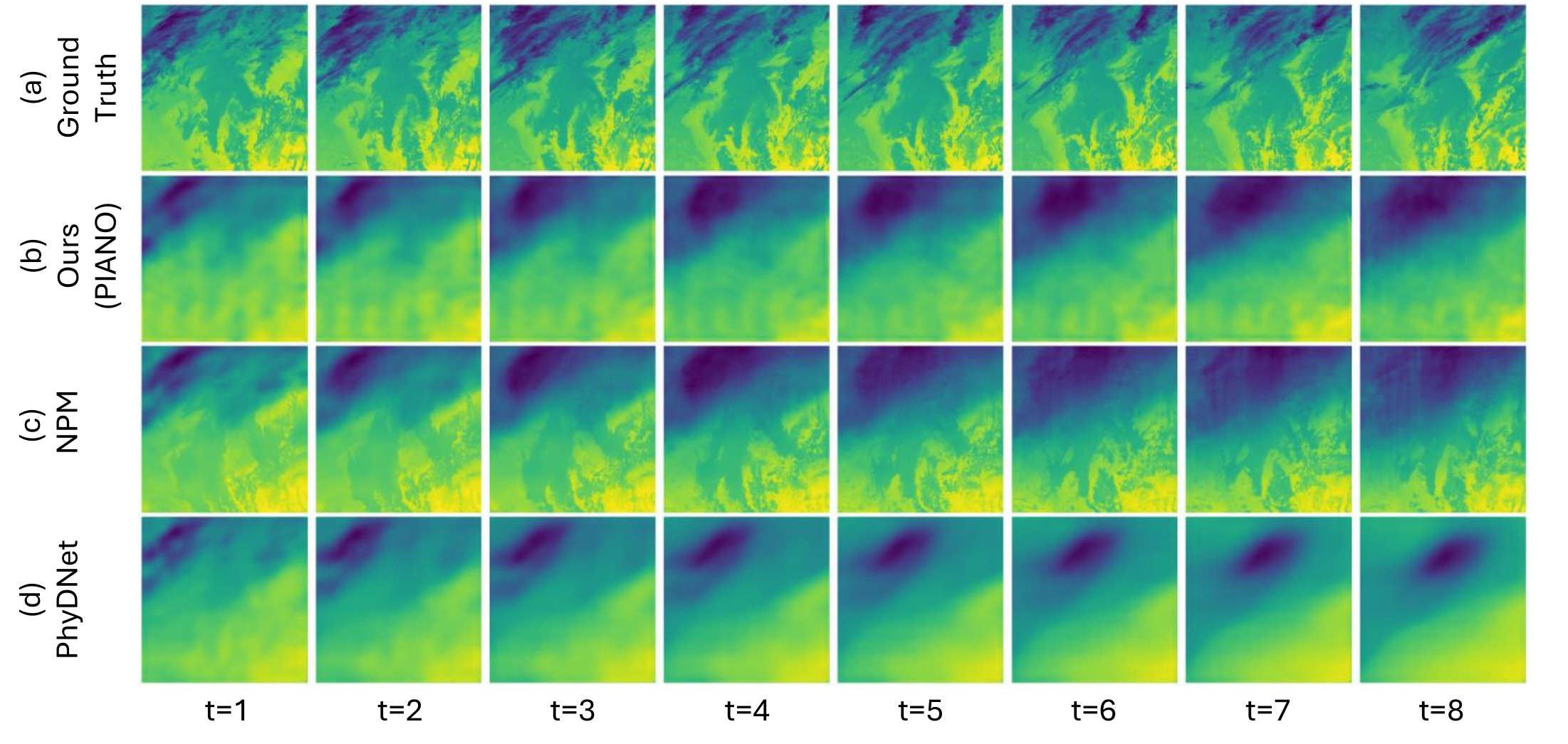
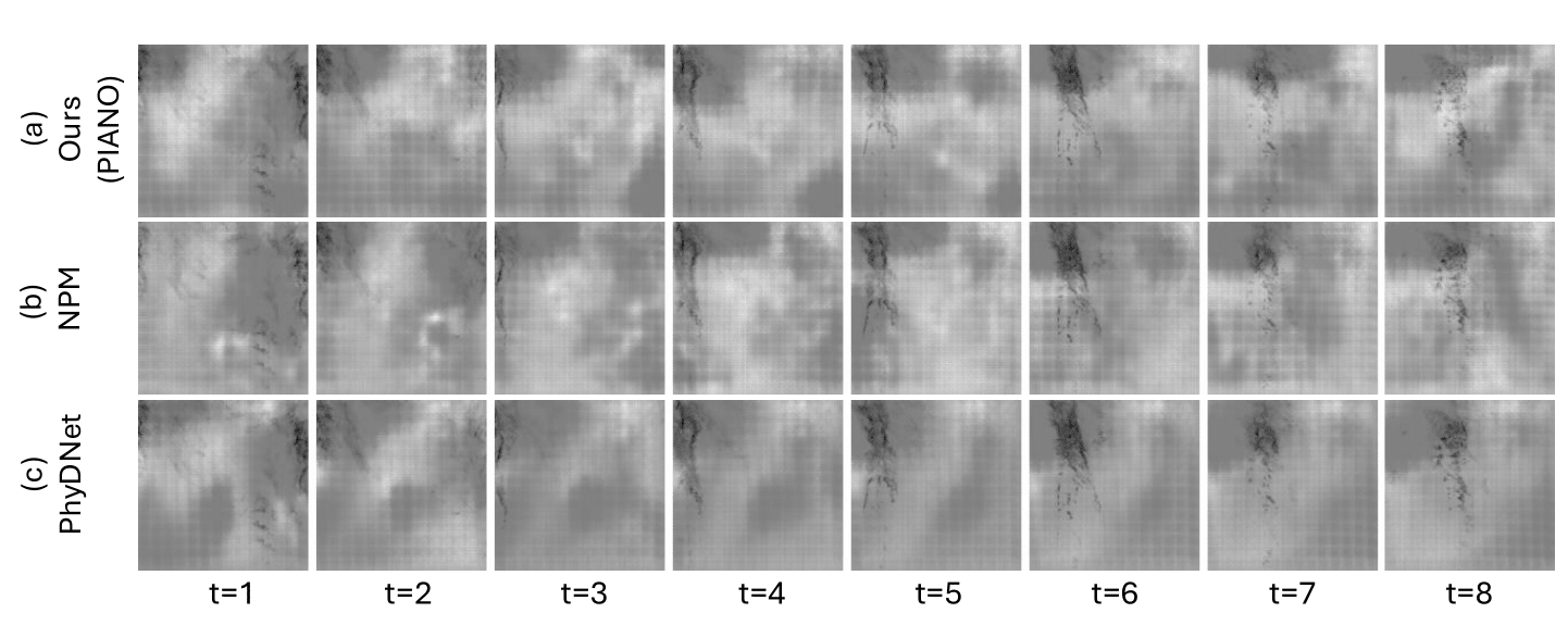
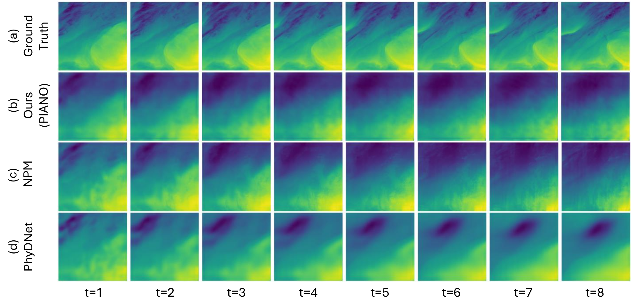
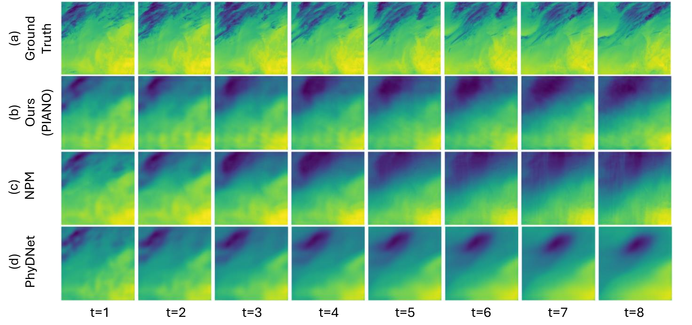
Precipitation nowcasting using satellite imagery emerges as a viable alternative, as satellite images have near-global coverage and are easily accessible. Indeed, a variety of studies (e.g., [Lebedev et al., 2019, Park et al., 2025, Gruca et al., 2022]) have already explored this possibility. However, these studies fail to take into account the foundational physics equations of atmospheric dynamics: an idea that has proven to improve predictive capabilities of AI-based weather prediction [Kochkov et al., 2024, Verma et al., 2024]. To this end, we propose a proof-of-concept PIANO (Physics-Informed duAl Neural Operator) for precipitation nowcasting based on satellite imagery that aims to produce physically consistent precipitation forecasts while maintaining overall accuracy.
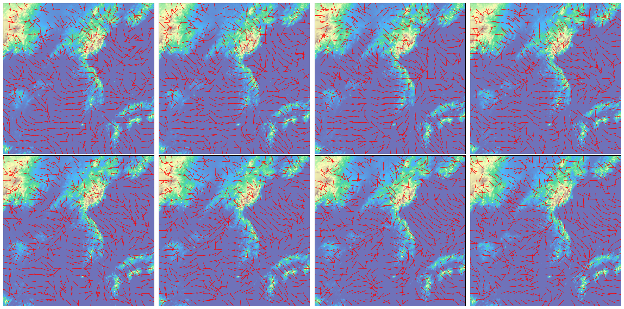
This section details the proposed PIANO, a novel architecture designed for satellite-based precipitation nowcasting. The core of PIANO lies in its unique dual structure, which decouples the task of data-driven temporal forecasting from the inference of latent physical dynamics. This separation allows for the explicit integration of physical principles, specifically the advection-diffusion equation, as a powerful inductive bias to regularize the learning process. As shown in the overall pipeline (Figure 1), the two operators run in series for the application of physics-informed neural networks (PINN) loss [Raissi et al., 2019, Dabrowski et al., 2023, Cho et al., 2024] and data driven loss. The Time-stepping Neural Operator (T-NO) is a datadriven operator that learns to advance the state forward in time, while the Velocity-extraction Neural Operator (V-NO) is a physics-informed operator that learns the underlying flow field responsible for evolving the satellite imagery. By decoupling these tasks into separate modules, we can enforce physical consistency via V-NO without constraining the expressiveness of T-NO.
T-NO takes input satellite images u t-s+1:t : {u t-s+1 , • • • , u t-1 , u t } and ψ where each u ∈ R C×H×W , represents a satellite image and ψ ∈ R H×W represents the digital elevation map. It outputs frames ût+1:t+s , which the V-NO takes as input to output vt:t+s . Both ût+1:t+s and vt+1:t+s are used to enforce a data-driven and PINN loss in a fashion similar to the physics-informed neural operator and the physics-informed deep neural operator [Goswami et al., 2023, Li et al., 2024]. The loss function is described further in the section below.
We then use a Pix2Pix [Isola et al., 2017] ResNet [He et al., 2016] trained using a Generative Adversarial Network [Goodfellow et al., 2014] structure with a ResNet generator and a ResNet-based discriminator network to transform predicted satellite images to radar images that can be used for precipitation nowcasting. The generative structure is motivated by the choice of [Park et al., 2025], whose work we aim to improve with this study.
We use a two-step training strategy where the V-NO and T-NO are pre-trained parallelly and combined for further fine tuning. In our study, T-NO takes eight time steps as input and output predictions of the next eight time steps, and V-NO takes eight time steps and outputs eight velocity fields.
Governing Equation: Advection-Diffusion Equation (Eq. ( 1)) Because we aim to model precipitation, we assume that the satellite images will evolve according to the governing advection-diffusion equation, which can be modeled as [Wesseling, 2001]:
where ∂u/∂t represents the local rate of change of the quantity u (in our case, the input of each layer in the satellite image), ⃗ v is the velocity vector
This content is AI-processed based on open access ArXiv data.