PALMS+: Modular Image-Based Floor Plan Localization Leveraging Depth Foundation Model
📝 Original Info
- Title: PALMS+: Modular Image-Based Floor Plan Localization Leveraging Depth Foundation Model
- ArXiv ID: 2511.09724
- Date: 2025-11-12
- Authors: 논문에 명시된 저자 정보가 제공되지 않았습니다. 원문 PDF 혹은 해당 GitHub 저장소의
README/CITATION파일을 확인하시기 바랍니다. —
📝 Abstract
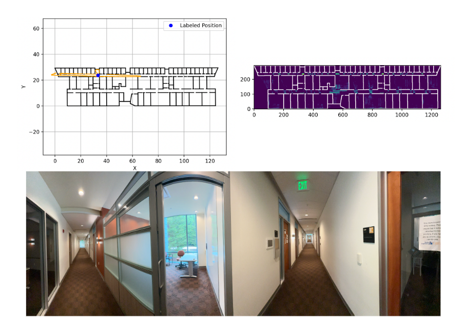
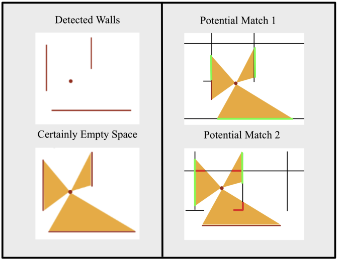
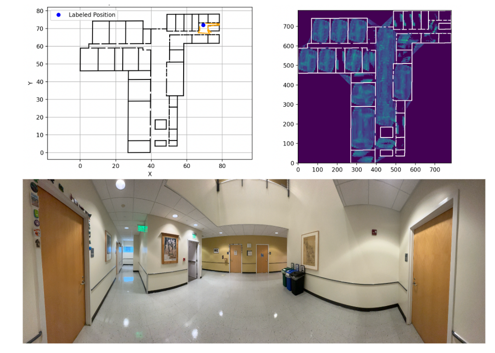
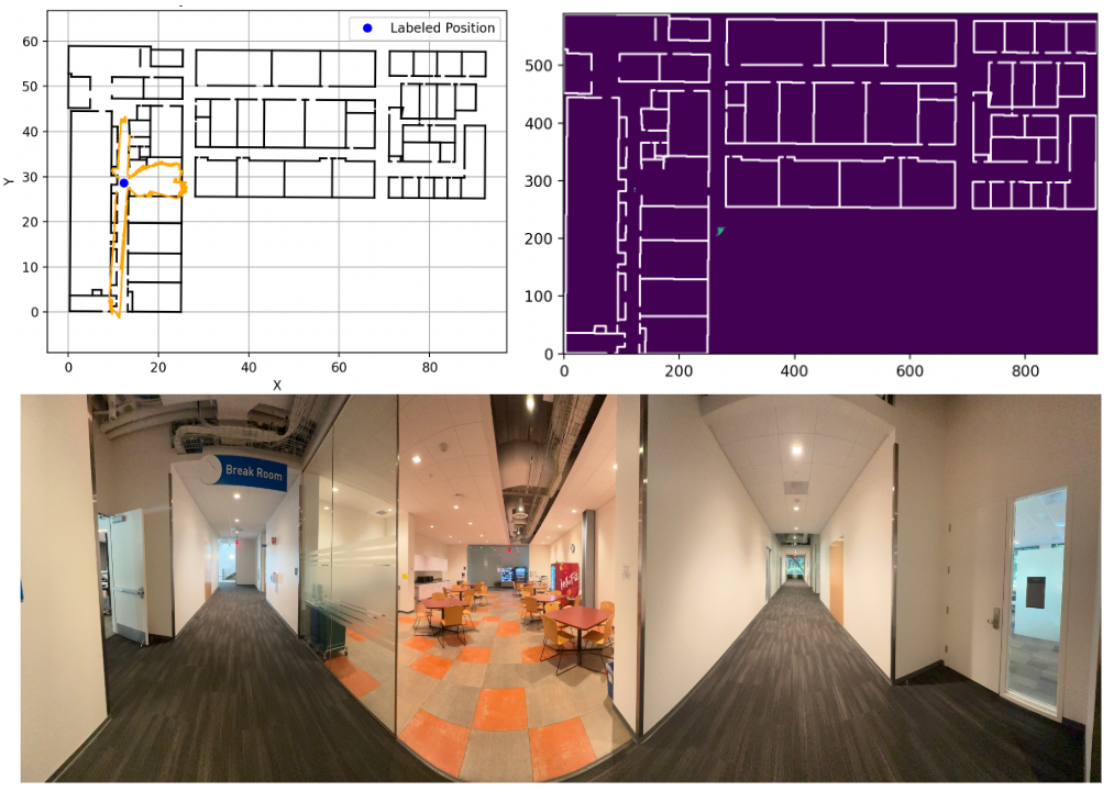
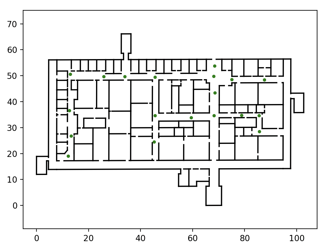
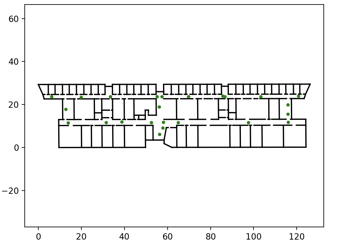
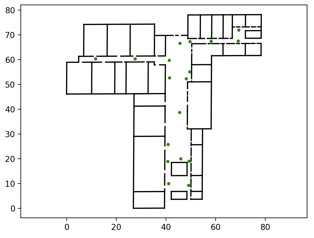
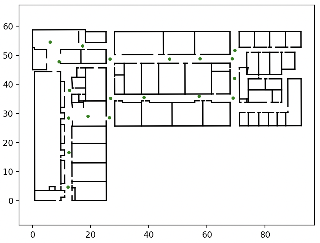
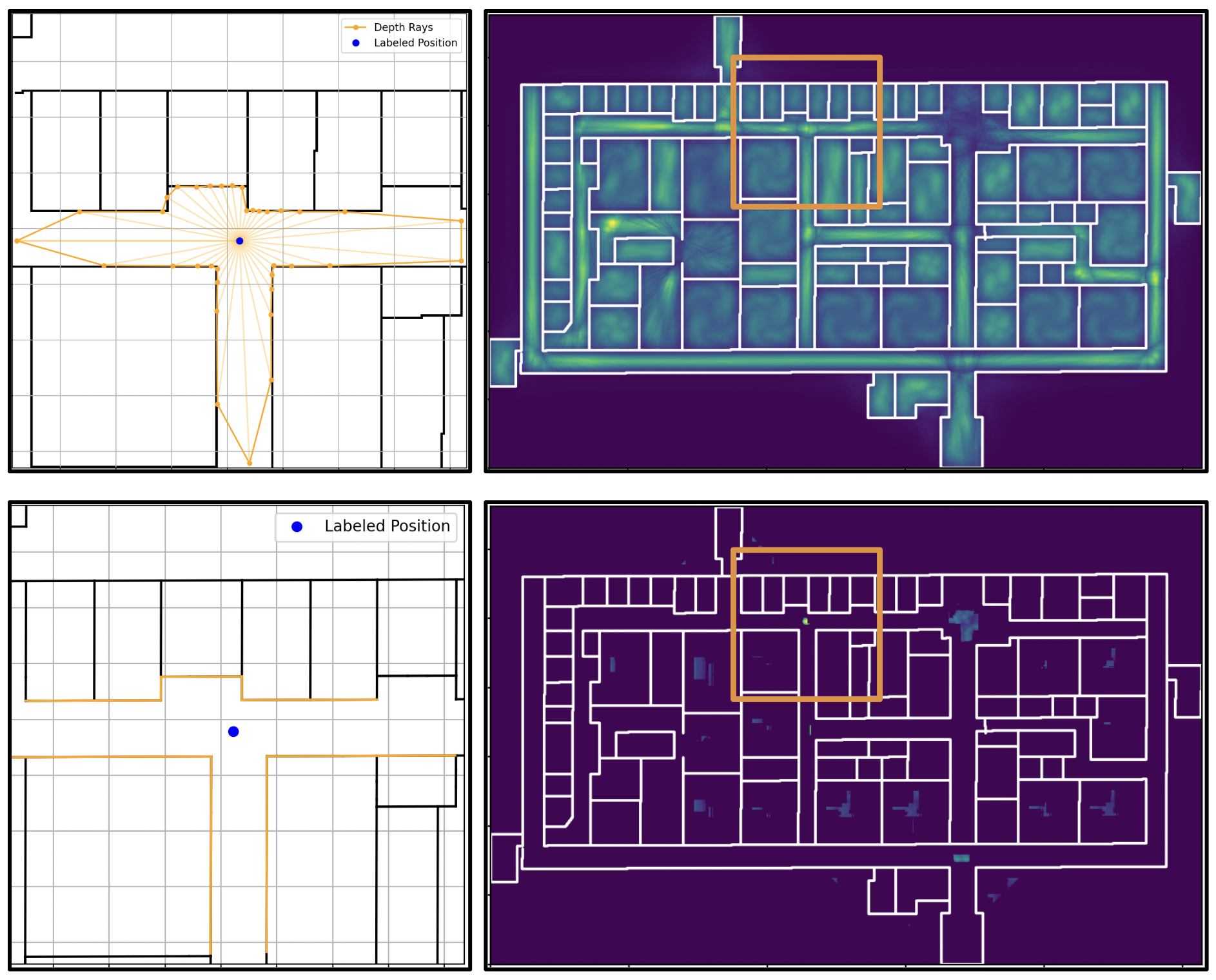
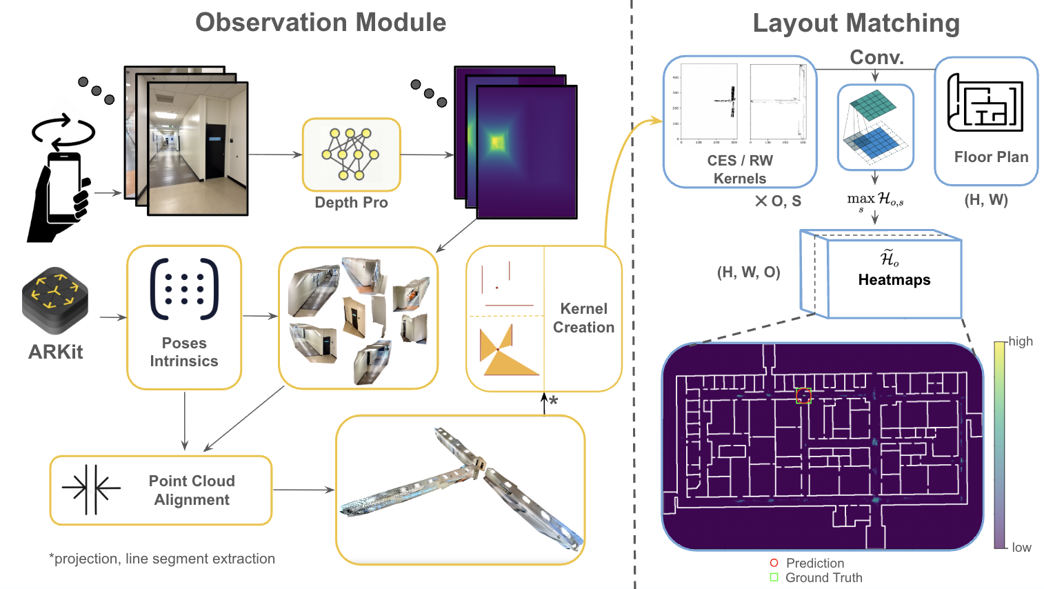
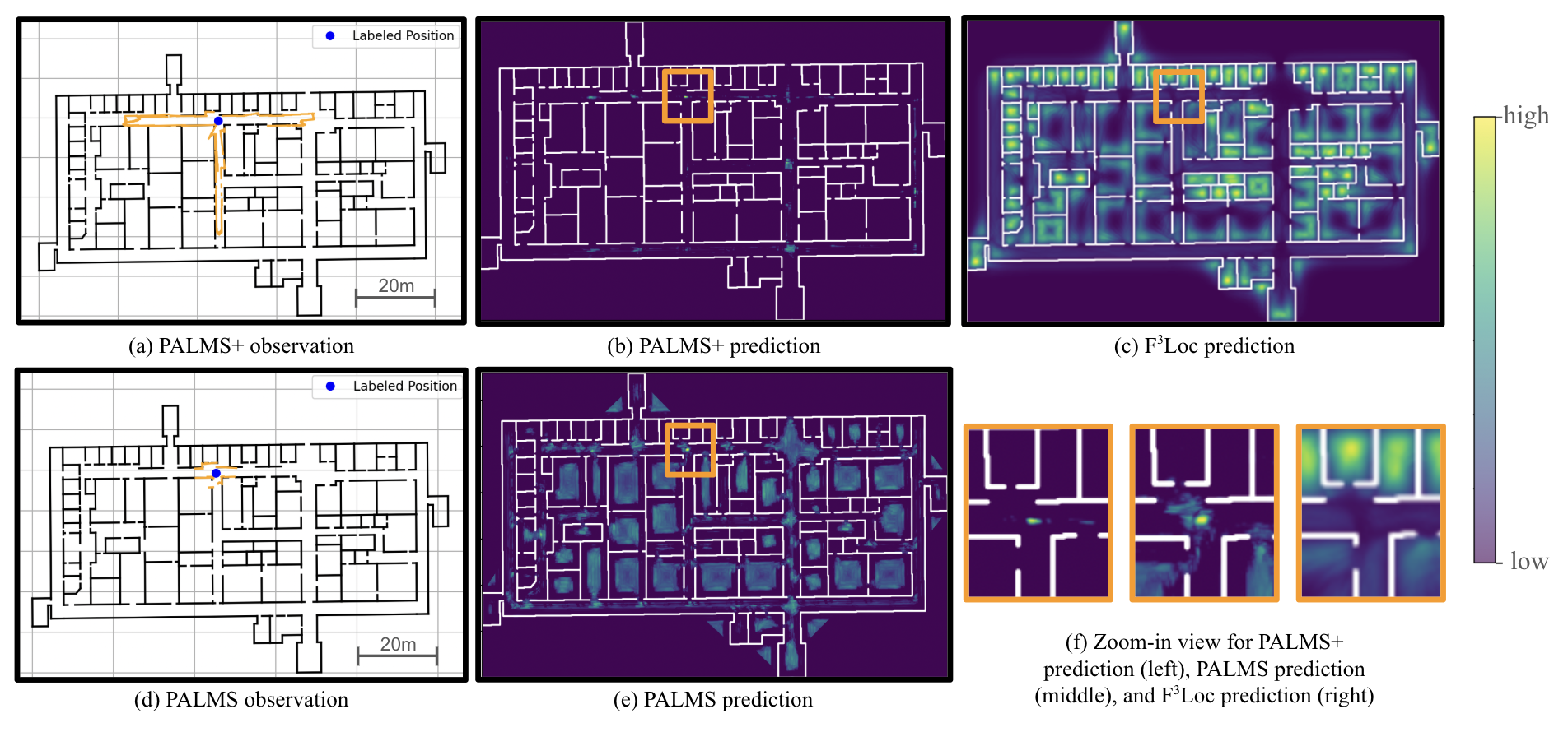
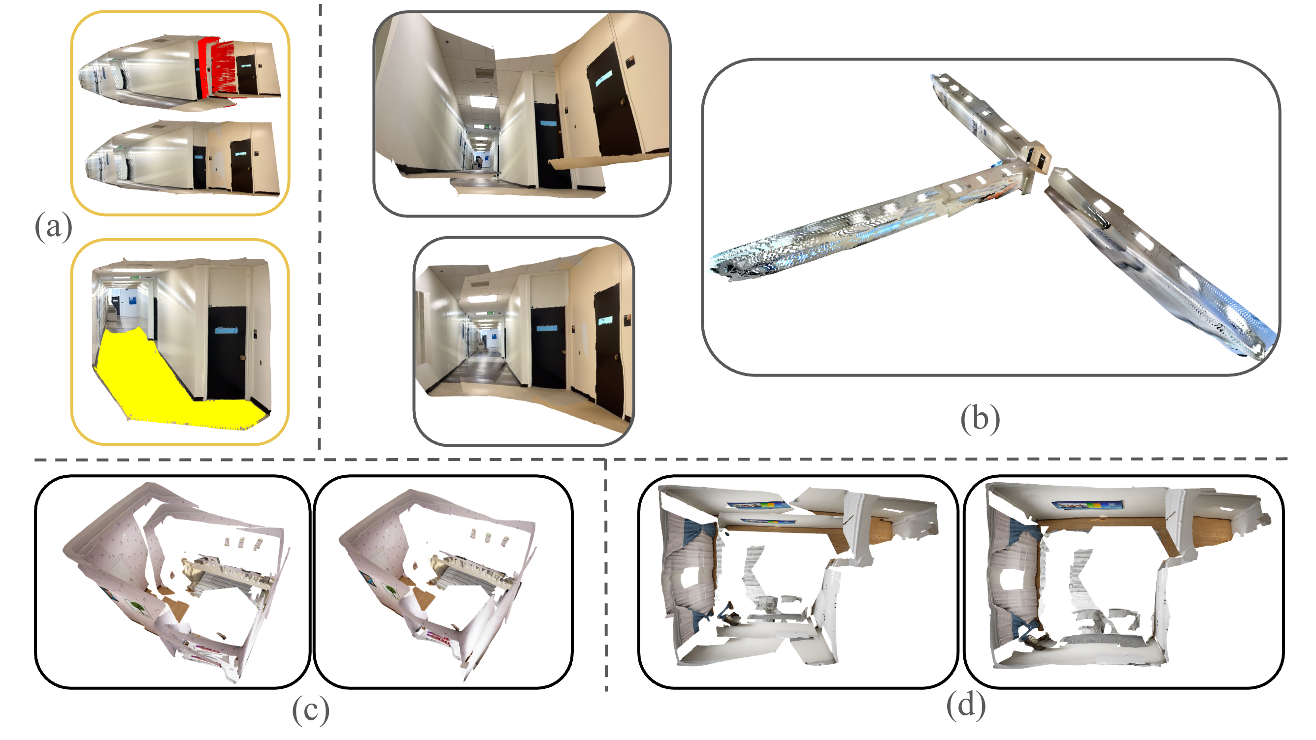
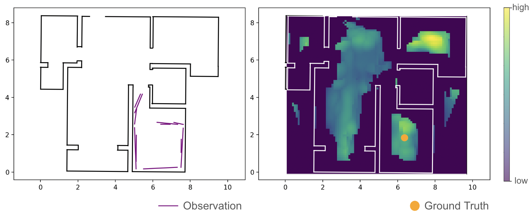
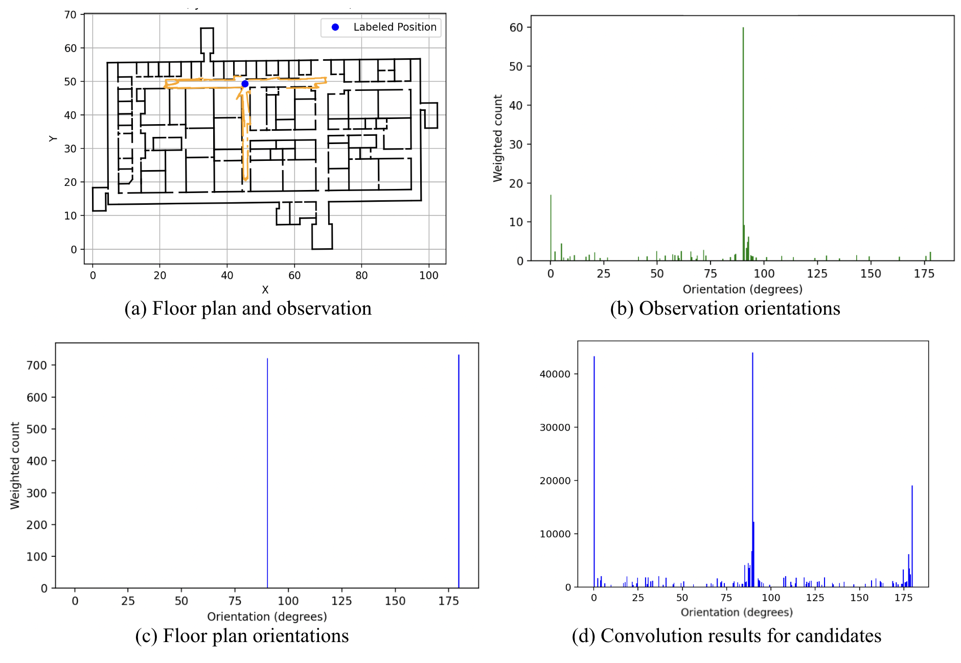
Indoor localization in GPS-denied environments is crucial for applications like emergency response and assistive navigation. Vision-based methods such as PALMS enable infrastructure-free localization using only a floor plan and a stationary scan, but are limited by the short range of smartphone LiDAR and ambiguity in indoor layouts. We propose PALMS$+$, a modular, image-based system that addresses these challenges by reconstructing scale-aligned 3D point clouds from posed RGB images using a foundation monocular depth estimation model (Depth Pro), followed by geometric layout matching via convolution with the floor plan. PALMS$+$ outputs a posterior over the location and orientation, usable for direct or sequential localization. Evaluated on the Structured3D and a custom campus dataset consisting of 80 observations across four large campus buildings, PALMS$+$ outperforms PALMS and F3Loc in stationary localization accuracy -- without requiring any training. Furthermore, when integrated with a particle filter for sequential localization on 33 real-world trajectories, PALMS$+$ achieved lower localization errors compared to other methods, demonstrating robustness for camera-free tracking and its potential for infrastructure-free applications. Code and data are available at https://github.com/Head-inthe-Cloud/PALMS-Plane-based-Accessible-Indoor-Localization-Using-Mobile-Smartphones💡 Deep Analysis
📄 Full Content
📸 Image Gallery
Reference
This content is AI-processed based on open access ArXiv data.