Measuring Fractal Dimension using Discrete Global Grid Systems
📝 Original Info
- Title: Measuring Fractal Dimension using Discrete Global Grid Systems
- ArXiv ID: 2506.18175
- Date: 2025-06-22
- Authors: 정보 없음 (논문에 명시된 저자 정보가 제공되지 않았습니다.)
📝 Abstract
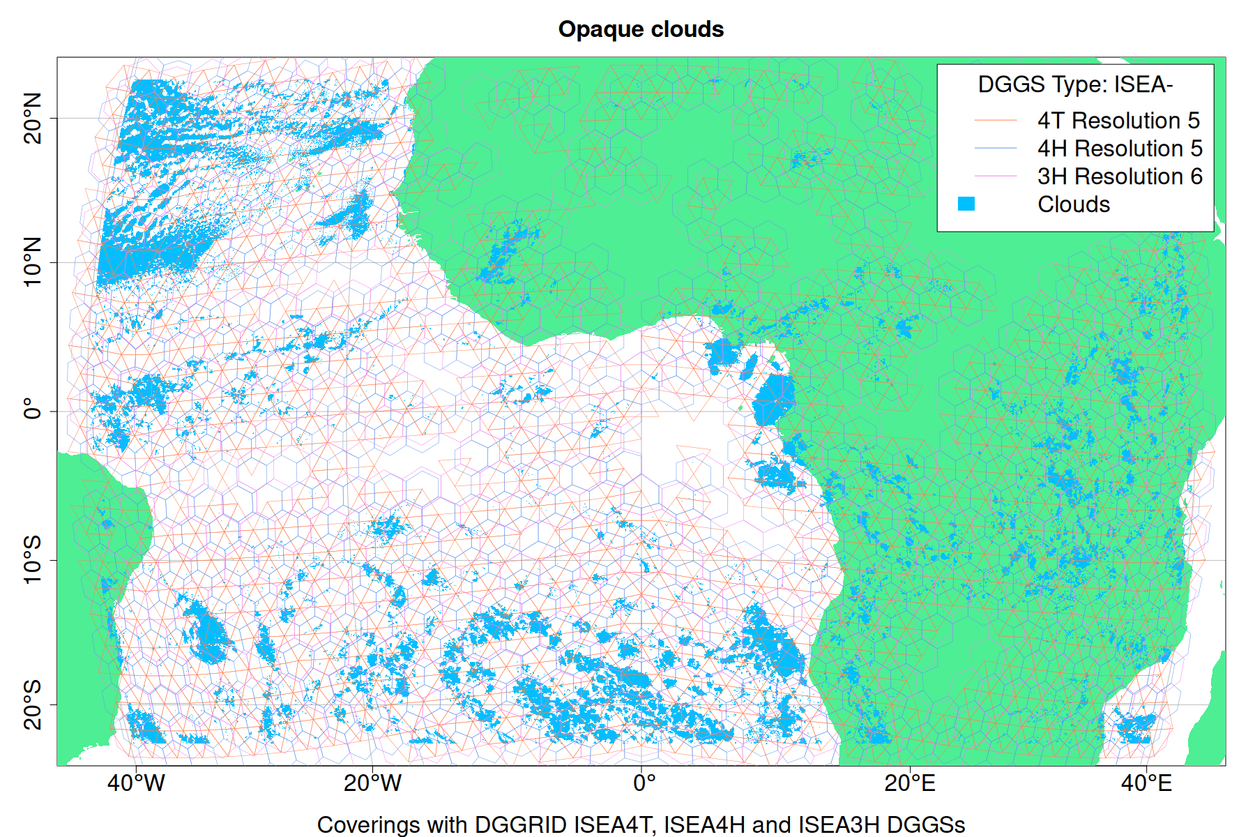
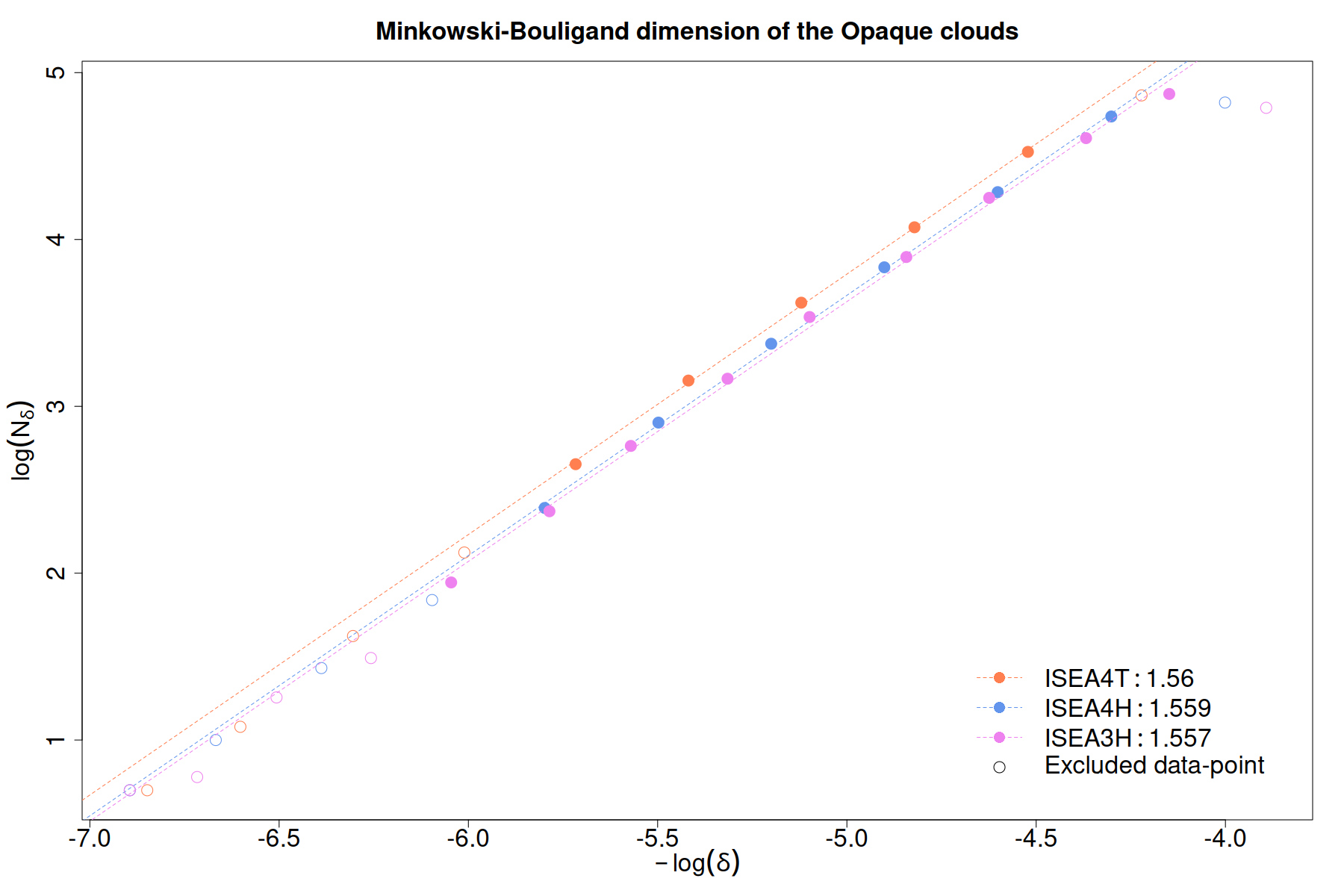
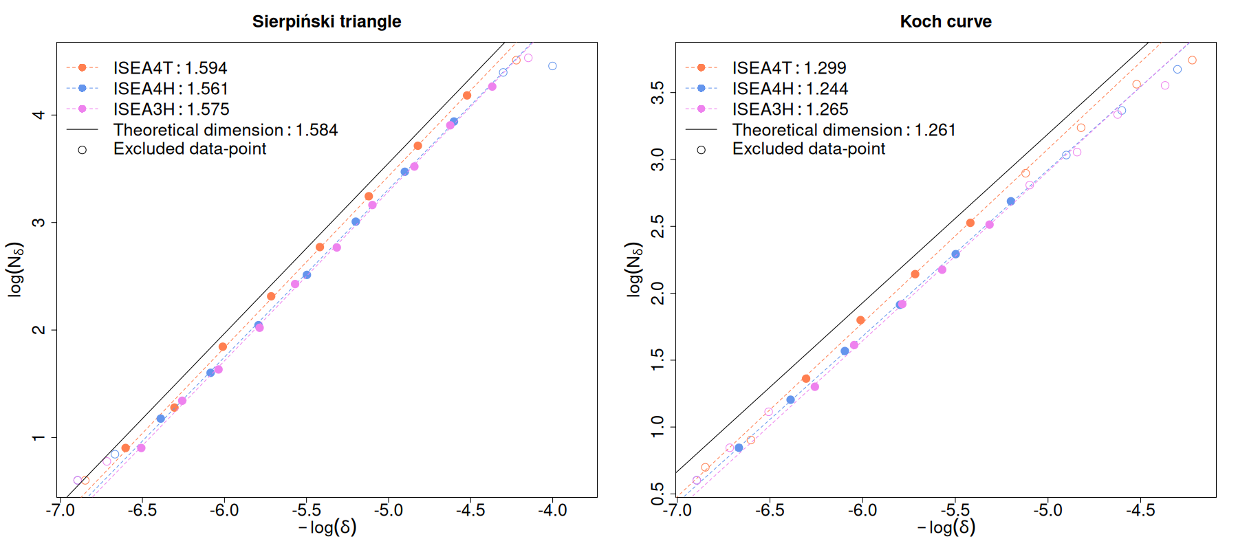
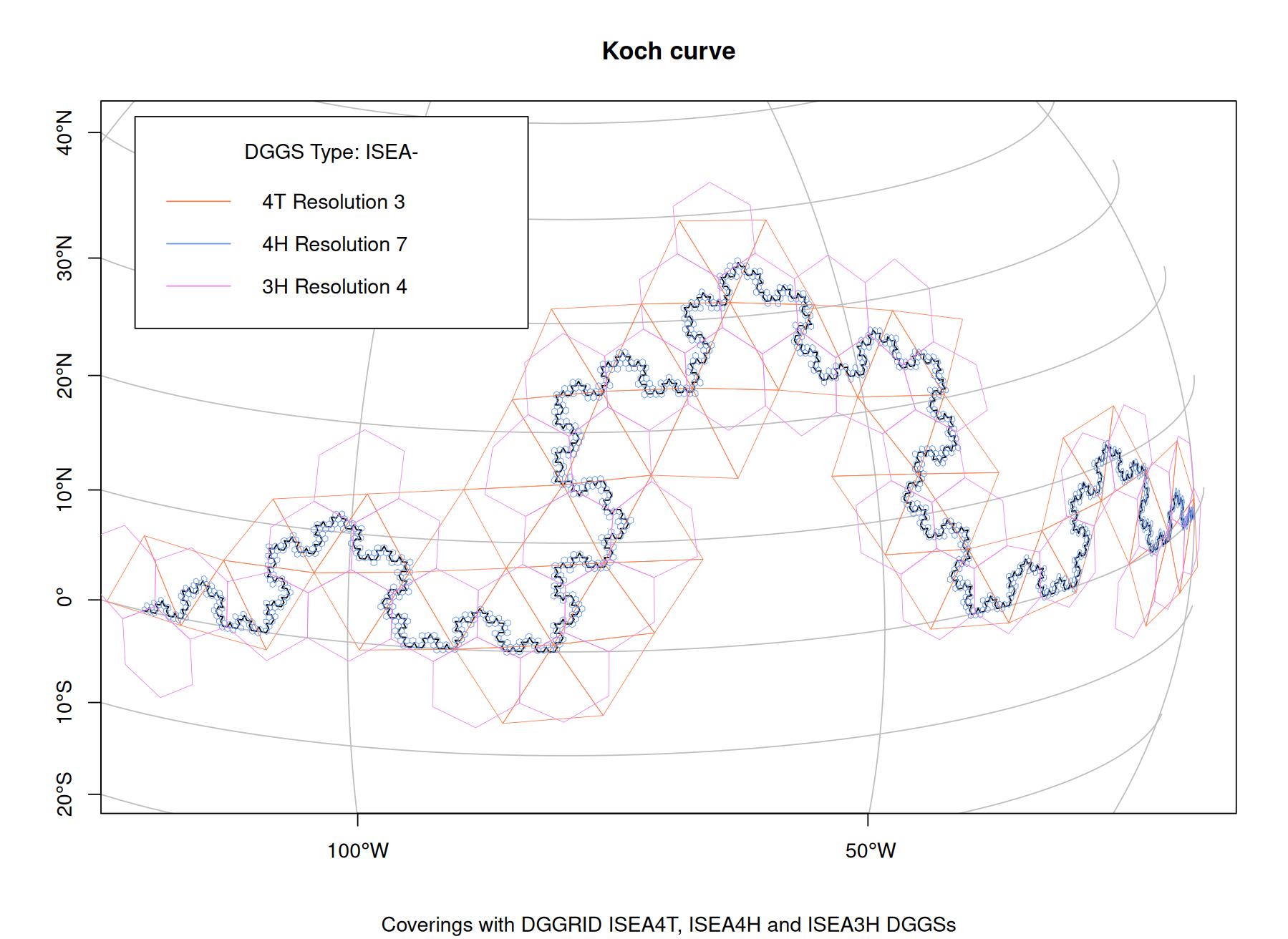
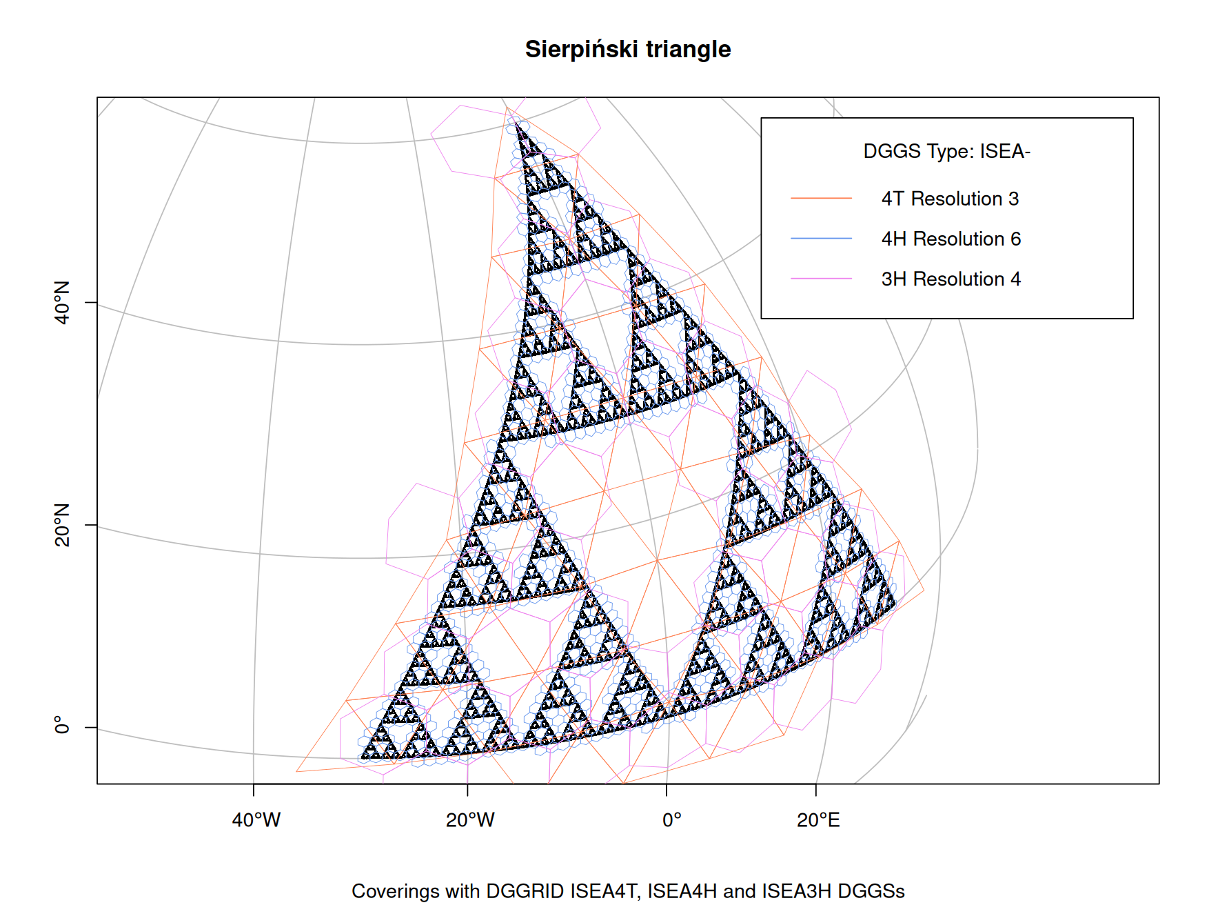
This study builds a bridge between two well-studied but distant topics: fractal dimension and Discrete Global Grid System (DGGS). DGGSs are used as covering sets for geospatial vector data to calculate the Minkowski-Bouligand dimension. Using the method on synthetic data yields results within 1% of their theoretical fractal dimensions. A case study on opaque cloud fields obtained from satellite images gives fractal dimension in agreement with that available in the literature. The proposed method alleviates the problems of arbitrary grid placement and orientation, as well as the progression of cell sizes of the covering sets for geospatial data. Using DGGSs further ensure that intersections of the covering sets with the geospatial vector having large geographic extents are calculated by taking the curvature of the earth into account. This paper establishes the validity of DGGSs as covering sets theoretically and discusses desirable properties of DGGSs suitable for this purpose.💡 Deep Analysis
📄 Full Content
📸 Image Gallery

Reference
This content is AI-processed based on open access ArXiv data.