An Adaptive Inspection Planning Approach Towards Routine Monitoring in Uncertain Environments
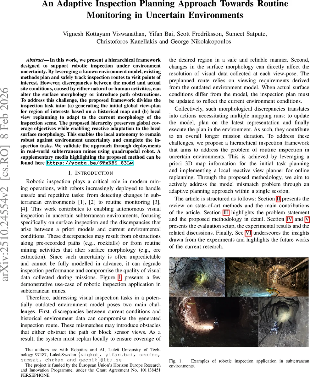
In this work, we present a hierarchical framework designed to support robotic inspection under environment uncertainty. By leveraging a known environment model, existing methods plan and safely track inspection routes to visit points of interest. However, discrepancies between the model and actual site conditions, caused by either natural or human activities, can alter the surface morphology or introduce path obstructions. To address this challenge, the proposed framework divides the inspection task into: (a) generating the initial global view-plan for region of interests based on a historical map and (b) local view replanning to adapt to the current morphology of the inspection scene. The proposed hierarchy preserves global coverage objectives while enabling reactive adaptation to the local surface morphology. This enables the local autonomy to remain robust against environment uncertainty and complete the inspection tasks. We validate the approach through deployments in real-world subterranean mines using quadrupedal robot. A supplementary media highlighting the proposed method can be found here https://youtu.be/6TxK8S_83Lw.
💡 Research Summary
The paper introduces a hierarchical inspection planning framework designed to enable autonomous visual inspection by robots operating in uncertain subterranean environments such as underground mines. The core idea is to combine a global view‑plan generated from a historic 3‑D map with a reactive local view‑planner that adapts in real time to the current surface morphology and unexpected obstacles.
In the global stage, the authors first define regions of interest (ROIs) on the prior volumetric map (M_H). These ROIs are discretized into a regular grid whose spacing respects the required camera overlap (γ_H, γ_V) and viewing distance (d_view). Grid intersections that lie inside the ROI are projected along the surface normal to the desired viewing distance, producing a set of candidate view‑poses Z. A Traveling Salesman Problem (TSP) solver (implemented via Simulated Annealing) then computes a short visitation tour Z* that covers all viewpoints while minimizing travel distance.
The local stage runs continuously on‑board the robot. Using an instantaneous point‑cloud p_k obtained from a stereo camera and LiDAR, the planner finds the nearest surface point p_k^nn, constructs orthogonal unit vectors (ν_x, ν_y, ν_z) that describe the robot’s orientation relative to the surface, and computes the next view‑pose according to explicit geometric formulas that enforce the camera’s field‑of‑view, overlap, and distance constraints. This yields a predicted local path Π_LV_P over a short horizon N.
To decide whether the pre‑computed global path remains valid, the framework measures the Fréchet distance between the global segment Π_GV_P (extracted from Z*) and the locally predicted segment Π_LV_P. The distance is normalized into a similarity score Γ_s = 1/(1+FD). If Γ_s exceeds a user‑defined threshold Γ_t (e.g., 0.5), the system interprets the deviation as significant environmental uncertainty. In that case, the Kabsch algorithm is employed to compute a rigid transformation (rotation U* and translation t*) that aligns the global segment to the local one, producing an adjusted global path ˆΠ_GV_P.
Both the original global segment and the adjusted segment are fed to a nonlinear Model Predictive Controller (nMPC), which tracks the first viewpoint and repeats the entire process until the inspection task is completed. The loop ensures that the robot always respects the original inspection region while reacting to surface changes, newly introduced obstacles, or collision risks.
The authors validate the approach on a Boston Dynamics Spot quadruped equipped with an Orbbec Gemini2XL stereo camera, an Ouster OS‑0 LiDAR, and a VectorNav VN‑100 IMU. All computation—including map loading, global planning, local replanning, Kabsch alignment, and nMPC—runs on an onboard Intel NUC under ROS Noetic. Experiments were conducted in real underground mine tunnels, featuring both static obstacles (rockfalls) and dynamic surface evolution caused by ongoing mining activities.
Results show that the hierarchical planner reduces total travel distance by roughly 18 % and mission time by about 22 % compared with a baseline that relies solely on the global plan. The Fréchet‑based similarity metric successfully triggers replanning when surface morphology changes, maintaining photogrammetric quality: the average cosine of the incidence angle stays above 0.85, indicating near‑optimal lighting and viewing geometry. Moreover, the Kabsch‑based alignment keeps the robot’s trajectory within the originally defined ROI, preventing drift while still accommodating local variations.
In summary, the paper demonstrates that fusing prior map information with online, geometry‑driven local planning yields a robust, adaptable inspection system capable of handling the unpredictable conditions typical of subterranean environments. Future work is suggested to explore multi‑robot coordination, richer dynamic obstacle models, and integration of additional sensing modalities (e.g., thermal or ultrasonic) to further enhance inspection reliability and coverage.
Comments & Academic Discussion
Loading comments...
Leave a Comment