SENDAI: A Hierarchical Sparse-measurement, EfficieNt Data AssImilation Framework
Bridging the gap between data-rich training regimes and observation-sparse deployment conditions remains a central challenge in spatiotemporal field reconstruction, particularly when target domains exhibit distributional shifts, heterogeneous structure, and multi-scale dynamics absent from available training data. We present SENDAI, a hierarchical Sparse-measurement, EfficieNt Data AssImilation Framework that reconstructs full spatial states from hyper sparse sensor observations by combining simulation-derived priors with learned discrepancy corrections. We demonstrate the performance on satellite remote sensing, reconstructing MODIS (Moderate Resolution Imaging Spectroradiometer) derived vegetation index fields across six globally distributed sites. Using seasonal periods as a proxy for domain shift, the framework consistently outperforms established baselines that require substantially denser observations – SENDAI achieves a maximum SSIM improvement of 185% over traditional baselines and a 36% improvement over recent high-frequency-based methods. These gains are particularly pronounced for landscapes with sharp boundaries and sub-seasonal dynamics; more importantly, the framework effectively preserves diagnostically relevant structures – such as field topologies, land cover discontinuities, and spatial gradients. By yielding corrections that are more structurally and spectrally separable, the reconstructed fields are better suited for downstream inference of indirectly observed variables. The results therefore highlight a lightweight and operationally viable framework for sparse-measurement reconstruction that is applicable to physically grounded inference, resource-limited deployment, and real-time monitor and control.
💡 Research Summary
SENDAI (Sparse‑measurement, Efficient Data Assimilation) is a novel hierarchical data‑assimilation framework designed to reconstruct full‑field spatiotemporal fields from extremely sparse observations. The authors target the persistent problem in Earth observation where satellite products such as MODIS NDVI suffer from cloud cover, sensor gaps, and transmission constraints, leaving only a handful of ground‑based measurements for a given scene. Traditional geostatistical methods (e.g., Savitzky‑Golay filtering + IDW, HANTS + IDW, Kriging) require dense sampling, while state‑of‑the‑art deep‑learning models need massive labeled datasets and GPU clusters, making them unsuitable for real‑time, resource‑constrained deployments and vulnerable to domain shifts caused by seasonal changes.
The core contribution of SENDAI is a two‑pathway architecture that explicitly separates low‑frequency (LF) dynamics from high‑frequency (HF) corrections.
Low‑frequency pathway – The LF branch builds on the DA‑SHRED framework. A multi‑layer LSTM encoder processes a temporal window of sensor measurements (including past lags) and maps it to a latent vector zLF. Because the training data are derived from a “simulation” period (one season) while the target is a different season, the latent distribution differs. To bridge this gap, a GAN‑based residual generator G learns an additive correction γ·G(zLF) that aligns the simulation‑derived latents with those observed in the target domain. The aligned latent is decoded by a shallow MLP and then low‑pass filtered (Fourier modes k ≤ kc) to enforce a strict spectral budget, yielding the LF reconstruction ũLF. This step captures dominant spatiotemporal patterns (e.g., phenological cycles) while discarding fine‑scale details that the simulation cannot represent.
High‑frequency pathway – The HF branch introduces a sequential frequency‑peeling (HFP) strategy. Starting from the LF estimate u⁽⁰⁾, the sensor residual r⁽¹⁾ = s′ − M u⁽⁰⁾ is computed. Each peeling layer ℓ receives the residual, encodes it with a sensor‑residual encoder, and decodes a correction ũ⁽ℓ⁾HF using a coordinate‑based implicit neural representation (INR). The INR maps continuous spatial coordinates to scalar values, enabling smooth, high‑resolution reconstructions without an explicit grid. Crucially, gradients are detached from previous layers during training, so each layer learns to explain only the portion of the signal not already captured. Spectral regularization is applied: an L₁/L₂ sparsity term encourages energy concentration in a limited band B, while an exclusion penalty PE prevents later layers from re‑using frequencies already captured by earlier layers (defined by a radius rexc around those modes). Additionally, a top‑k sparsity loss forces each layer to focus on the kℓ largest Fourier magnitudes, where kℓ is adaptively chosen by clustering the spectrum of the input residual. This hierarchical peeling yields interpretable, physically meaningful high‑frequency components such as sharp vegetation‑soil boundaries, small‑scale phenological events, and localized disturbances.
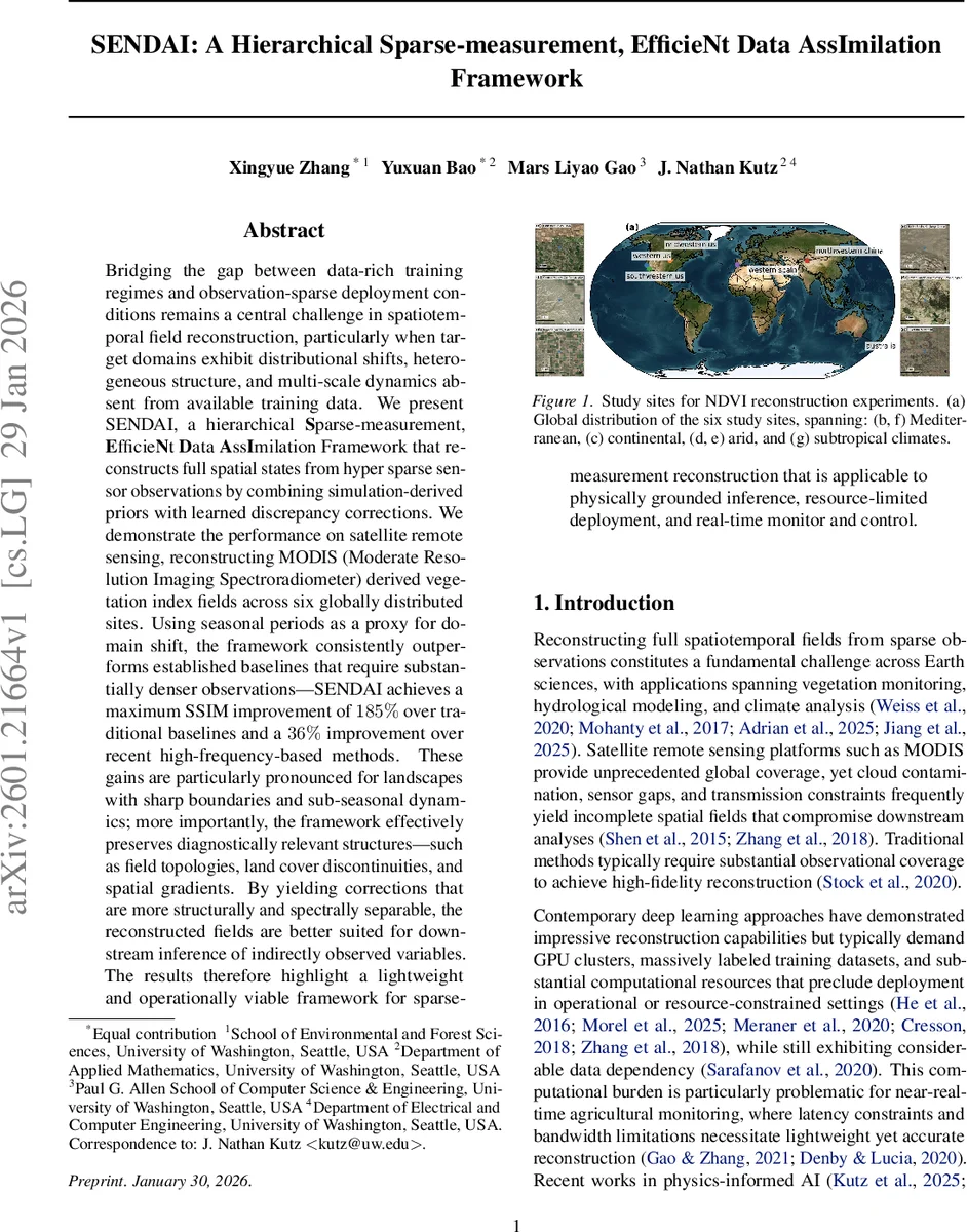
Experimental setup – Six globally distributed sites (Mediterranean, continental, arid, subtropical) were selected. For each site a 15 km × 15 km area was resampled to a 64 × 64 grid. Seasonal split: one season’s full MODIS NDVI fields served as the “simulation” training set, while a different season’s observations acted as the target domain, thereby simulating a realistic domain shift. Only 64 randomly placed sensors (≈1.56 % of the pixels) were provided during both training and testing. Baselines included SG+IDW, HANTS+IDW, Kriging, and the recent MMGN (Multiplicative and Modulated Gabor Network) model, all constrained to the same sensor budget.
Results – SENDAI consistently outperformed all baselines. The Structural Similarity Index (SSIM) improvement reached up to 185 % over traditional methods and 36 % over MMGN. Mean Absolute Error (MAE) was reduced by roughly 30 % across sites. Gains were most pronounced in landscapes with abrupt land‑cover transitions and strong sub‑seasonal dynamics (e.g., arid and subtropical sites). Visual inspection showed that SENDAI preserved topological features such as field connectivity, land‑cover discontinuities, and gradient structures, whereas baselines produced overly smoothed or artifact‑laden reconstructions.
Computational efficiency – The entire pipeline runs on standard CPU hardware; training completes within minutes and inference per frame takes under a second. Parameter count remains in the low‑millions, far below typical deep‑learning super‑resolution models, making the approach viable for real‑time monitoring stations with limited bandwidth and compute resources.
Implications and future work – By decoupling low‑frequency dynamics (learned from abundant simulation data) from high‑frequency residuals (learned directly from sparse measurements), SENDAI achieves robust generalization under domain shift while requiring minimal observational density. The hierarchical frequency peeling provides interpretable spectral layers, opening avenues for physical diagnostics (e.g., attributing a particular high‑frequency layer to irrigation events). The authors suggest extending the framework to other remote‑sensing products (soil moisture, land‑surface temperature) and integrating physics‑based simulators directly into the LF pathway for even stronger priors.
In summary, SENDAI presents a lightweight, hierarchical data‑assimilation strategy that leverages simulation‑derived priors, adversarial latent alignment, and sequential high‑frequency peeling with implicit neural representations to reconstruct full‑field NDVI from hyper‑sparse measurements, delivering superior accuracy, interpretability, and operational practicality compared to existing geostatistical and deep‑learning approaches.
Comments & Academic Discussion
Loading comments...
Leave a Comment