Groundwater vulnerability assessment in semi-arid regions using GIS-based DRASTIC models and FUZZY AHP: South Chott Hodna
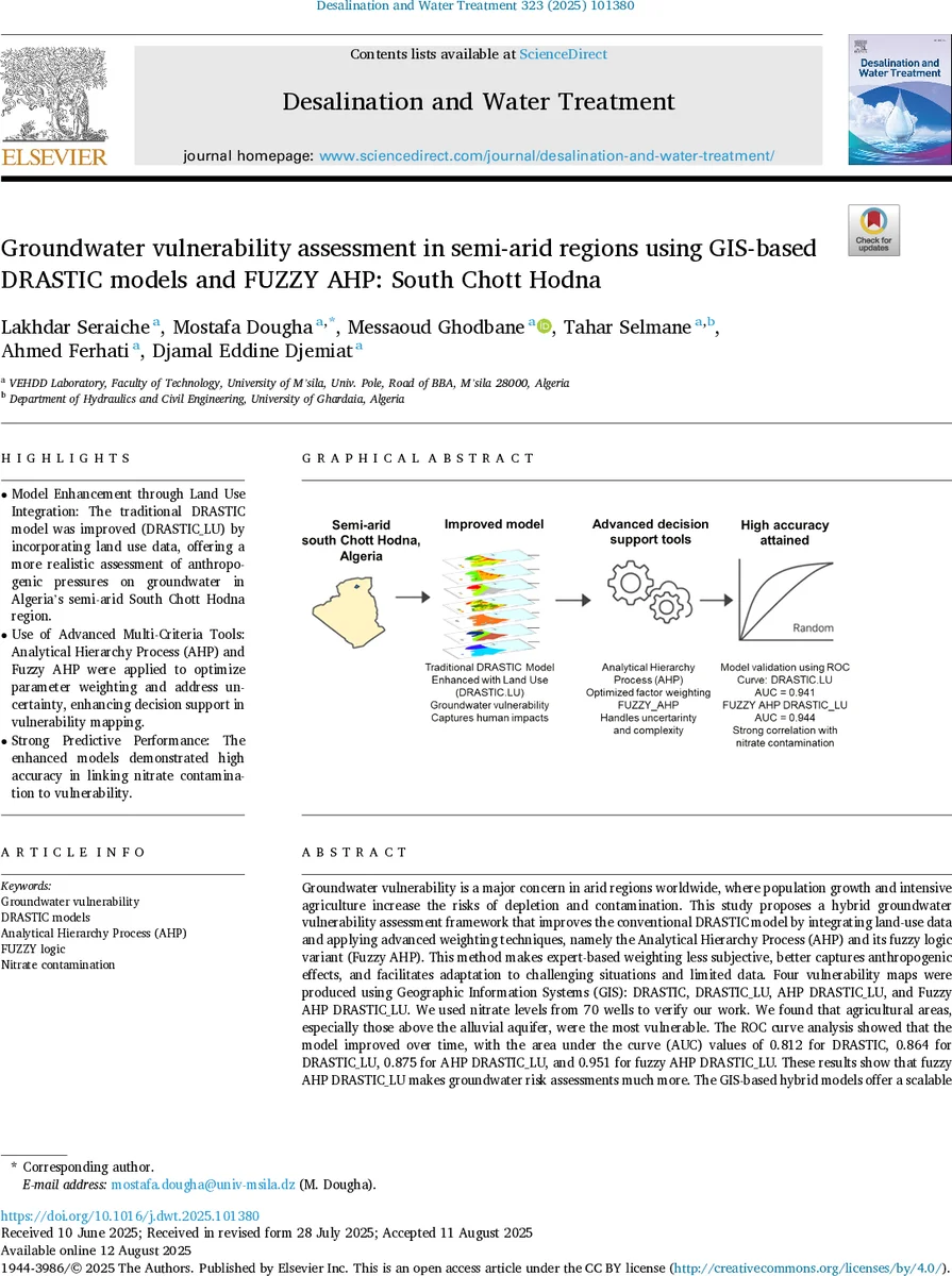
Groundwater vulnerability is a major concern in arid regions worldwide, where population growth and intensive agriculture increase the risks of depletion and contamination. This study proposes a hybrid groundwater vulnerability assessment framework that improves the conventional DRASTIC model by integrating land-use data and applying advanced weighting techniques, namely the Analytical Hierarchy Process (AHP) and its fuzzy logic variant (Fuzzy AHP). This method makes expert-based weighting less subjective, better captures anthropogenic effects, and facilitates adaptation to challenging situations and limited data. Four vulnerability maps were produced using Geographic Information Systems (GIS): DRASTIC, DRASTIC_LU, AHP DRASTIC_LU, and Fuzzy AHP DRASTIC_LU. We used nitrate levels from 70 wells to verify our work. We found that agricultural areas, especially those above the alluvial aquifer, were the most vulnerable. The ROC curve analysis showed that the model improved over time, with the area under the curve (AUC) values of 0.812 for DRASTIC, 0.864 for DRASTIC_LU, 0.875 for AHP DRASTIC_LU, and 0.951 for fuzzy AHP DRASTIC_LU. These results show that fuzzy AHP DRASTIC_LU makes groundwater risk assessments much more. The GIS-based hybrid models offer a scalable and transferable method for mapping vulnerability, but they also provide local and regional water resource managers with useful information.
💡 Research Summary
The paper presents a hybrid groundwater vulnerability assessment framework applied to the semi‑arid South Chott Hodna basin in Algeria. Recognizing the limitations of the conventional DRASTIC index—fixed weights and omission of anthropogenic pressures—the authors enhance the model in two major ways. First, they integrate a land‑use (LU) layer, creating a DRASTIC_LU version that captures the spatial distribution of agriculture, urban areas, septic systems, and barren land. Second, they replace the static expert‑assigned weights with those derived from the Analytical Hierarchy Process (AHP) and its fuzzy‑logic extension (Fuzzy AHP), thereby reducing subjectivity and accounting for uncertainty in pairwise comparisons.
Nine thematic GIS layers (Depth to water, Net recharge, Aquifer media, Soil media, Topography, Vadose zone impact, Hydraulic conductivity, and Land use) were rasterized, classified into five vulnerability classes using Jenks natural breaks, and weighted (1–5) according to both the original DRASTIC scheme and the optimized AHP/Fuzzy AHP schemes. The authors collected nitrate concentrations from 70 wells during a 2023 field campaign; these measurements served as the validation dataset. Receiver Operating Characteristic (ROC) curve analysis yielded Area Under the Curve (AUC) values of 0.812 for the original DRASTIC, 0.864 for DRASTIC_LU, 0.875 for AHP‑DRASTIC_LU, and 0.951 for Fuzzy AHP‑DRASTIC_LU, demonstrating a clear performance improvement with each successive enhancement.
Spatial results identified the Maadher Plain and the Wadi Maitre/Bou Saada corridors as the most vulnerable zones, coinciding with the highest observed nitrate levels (up to 300 mg L⁻¹, far exceeding the WHO limit of 50 mg L⁻¹). The fuzzy‑AHP weighting particularly excelled in balancing sensitivity (0.92) and specificity (0.89), indicating robust discrimination between contaminated and safe areas even under data scarcity.
The study concludes that the GIS‑based DRASTIC‑LU model, when coupled with fuzzy‑AHP weighting, provides a scalable, transferable, and highly accurate tool for groundwater risk mapping in data‑limited, semi‑arid environments. It offers water managers actionable information for prioritizing protection and remediation efforts. The authors suggest future work incorporating machine‑learning variable selection, temporal land‑use dynamics, and multi‑contaminant assessments to further refine the framework.
Comments & Academic Discussion
Loading comments...
Leave a Comment