Joint Optimization of Multi-UAV Deployment and 3D Positioning in Traffic-Aware Aerial Networks
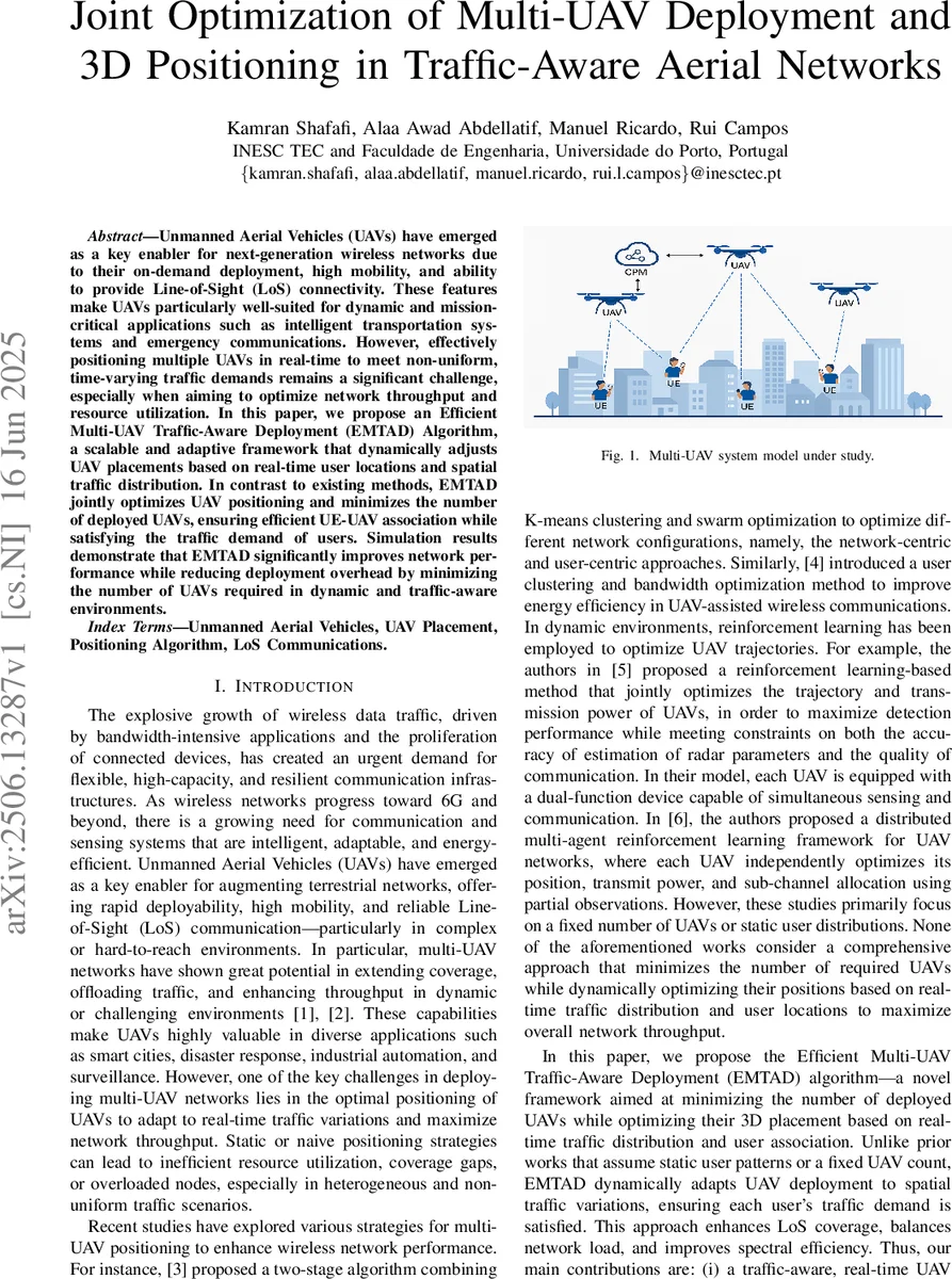
Unmanned Aerial Vehicles (UAVs) have emerged as a key enabler for next-generation wireless networks due to their on-demand deployment, high mobility, and ability to provide Line-of-Sight (LoS) connectivity. These features make UAVs particularly well-suited for dynamic and mission-critical applications such as intelligent transportation systems and emergency communications. However, effectively positioning multiple UAVs in real-time to meet non-uniform, time-varying traffic demands remains a significant challenge, especially when aiming to optimize network throughput and resource utilization. In this paper, we propose an Efficient Multi-UAV Traffic-Aware Deployment (EMTAD) Algorithm, a scalable and adaptive framework that dynamically adjusts UAV placements based on real-time user locations and spatial traffic distribution. In contrast to existing methods, EMTAD jointly optimizes UAV positioning and minimizes the number of deployed UAVs, ensuring efficient UE-UAV association while satisfying the traffic demand of users. Simulation results demonstrate that EMTAD significantly improves network performance while reducing deployment overhead by minimizing the number of UAVs required in dynamic and traffic-aware environments.
💡 Research Summary
The paper addresses a fundamental challenge in UAV‑assisted wireless networks: how to dynamically place multiple aerial base stations so that they both satisfy heterogeneous, time‑varying traffic demands and use as few UAVs as possible. Existing works either assume a fixed number of UAVs or static user distributions, which leads to inefficient resource use, coverage gaps, or overloaded nodes when traffic is non‑uniform and changes over time. To overcome these limitations, the authors propose the Efficient Multi‑UAV Traffic‑Aware Deployment (EMTAD) algorithm, a two‑stage heuristic that jointly minimizes the number of deployed UAVs and determines their optimal three‑dimensional (3‑D) positions while guaranteeing that every user equipment (UE) meets its required data rate.
System Model and Problem Formulation
The network consists of N ground UEs randomly distributed over an area (urban, suburban, rural, etc.) and a pool of up to Kmax = N potential UAVs. Each UAV can be activated (binary variable ak) and positioned at a 3‑D coordinate Pk = (xk, yk, zk). The LoS probability between UE i and UAV k follows the Al‑Hourani model with environment‑specific constants c1 and c2. Using this probability, the average channel gain Ωik and the achievable data rate Rik are expressed in closed form (Eqs. 3‑4). The joint optimization problem (denoted P) seeks to minimize Σk ak subject to: (i) each UE’s data‑rate demand Ti(τ) is satisfied (Rik ≥ Ti), (ii) the total bandwidth allocated by a UAV does not exceed its capacity BMAXk, (iii) each UE is associated with exactly one active UAV (binary association variable zik), and (iv) the binary nature of ak and zik. Because the problem mixes integer decisions with a nonlinear rate constraint, it is a mixed‑integer nonlinear program (MINLP) and is NP‑hard, making exact solutions infeasible for realistic network sizes.
EMTAD Algorithm – Core Ideas
- Traffic‑aware distance bound – For each UE i, the algorithm computes a maximum allowable distance dMAX,ik that guarantees the required data rate given the current bandwidth, transmit power, and LoS probability (Eq. 6). This distance defines a spherical coverage region Si centered at the UE.
- Spatial clustering via coverage intersection – The algorithm examines intersections of two or more spheres Si. An intersection region sp ⊂ ℝ³ represents a location where a single UAV could simultaneously serve all UEs whose spheres contribute to that intersection while respecting each UE’s dMAX bound. By enumerating intersections from larger groups down to pairs, EMTAD finds the smallest set of intersecting regions that collectively cover all UEs. This step effectively reduces the number of required UAVs by exploiting spatial proximity and compatible traffic demands.
- 3‑D positioning refinement with Particle Swarm Optimization (PSO) – For each selected intersection region, a PSO search is launched to locate the optimal UAV position Pk inside the region. The fitness function is multi‑objective: (a) maximize the number of UEs served by the UAV (subject to the bandwidth constraint), (b) keep all UE‑UAV distances below their respective dMAX values, and (c) favor high LoS probability (i.e., larger elevation angles). PSO parameters (30 particles, 100 iterations, inertia weight 0.7, etc.) and an early‑stopping rule (perfect solution for 10 consecutive iterations) are used to keep computational load reasonable.
- Iterative reduction of UAV count – Starting with Kmax = N, EMTAD attempts to find a feasible deployment. If successful, Kmax is decremented and the process repeats, thereby searching for the minimal feasible number of UAVs. The best solution (minimum ak, maximum achieved throughput) is retained.
Performance Evaluation
Simulations are conducted for several environment types (urban, suburban, rural) using realistic LoS parameters. EMTAD is compared against baseline schemes such as a two‑stage K‑means + PSO method, fixed‑UAV placement, and reinforcement‑learning trajectory designs. Results show that EMTAD reduces the required UAV count by roughly 30–40 % while increasing total network throughput by 15–25 % relative to the baselines. The algorithm also maintains a high LoS probability (ε ≥ 0.9) for most links, indicating robust connectivity even in dense urban settings. Moreover, when traffic demands change abruptly, EMTAD can recompute placements in near‑real time, limiting service interruption.
Strengths
- Joint optimization of UAV count and 3‑D placement – Few works address both simultaneously; EMTAD fills this gap.
- Traffic‑aware distance bound – Deriving dMAX directly from the rate constraint provides a principled way to translate QoS requirements into geometric constraints.
- Hybrid heuristic (geometric clustering + PSO) – The two‑stage approach balances global search (intersection identification) with fine‑grained local optimization, achieving near‑optimal performance with manageable complexity.
- Scalability – By pruning the search space through sphere intersections, the algorithm avoids exhaustive enumeration of all possible UAV locations, making it suitable for moderately large networks.
Limitations and Open Issues
- Centralized control assumption – EMTAD relies on a cloud‑based Central Processing Module that gathers all UE positions and traffic demands, which may introduce signaling overhead and latency in highly dynamic scenarios.
- PSO sensitivity – Convergence speed and solution quality depend on particle initialization and parameter tuning; sub‑optimal settings could degrade performance.
- Neglected UAV operational constraints – Battery life, flight time, no‑fly zones, and wind effects are not modeled, potentially limiting real‑world applicability.
- Computational cost of intersection enumeration – Although the algorithm reduces complexity compared to brute‑force, the worst‑case number of sphere intersections grows combinatorially with N; heuristic pruning strategies are needed for very dense user deployments.
Future Research Directions
- Distributed or hierarchical control – Develop multi‑agent frameworks where UAVs exchange local information to reduce reliance on a central controller.
- Reinforcement‑learning augmentation – Use RL to guide PSO initialization or to learn policies for rapid re‑deployment under abrupt traffic spikes.
- Energy‑aware modeling – Incorporate UAV battery consumption, charging logistics, and flight‑time constraints into the optimization problem.
- Robustness to imperfect information – Study the impact of delayed or noisy UE location/traffic reports and design robust variants of EMTAD.
- Field trials – Validate the algorithm on real UAV platforms and 5G/6G testbeds to assess practical feasibility and to refine the LoS model with empirical data.
Conclusion
The EMTAD framework introduces a novel, traffic‑aware methodology for deploying multiple UAV base stations. By converting QoS requirements into geometric coverage spheres, exploiting their intersections to minimize UAV count, and refining positions with PSO, the algorithm achieves substantial gains in throughput and deployment efficiency. While the current formulation assumes idealized UAV operation and centralized control, the presented results demonstrate the strong potential of joint UAV‑count and 3‑D placement optimization for future aerial networks, especially in scenarios demanding rapid, adaptive, and cost‑effective wireless coverage.
Comments & Academic Discussion
Loading comments...
Leave a Comment