A New Approach to Reporting Archaeological Surveys: Connecting Rough Cilicia, Visible Past and Open Context through loose coupling and 3d codes
The project presents the strategy adopted by the Rough Cilicia Archaeological Survey team for publishing its primary data and reports via three potentially transformative strategies for digital humanities: Loose coupling of digital data curation and publishing platforms. In loosely coupled systems, components share only a limited set of simple assumptions, which enables systems to evolve dynamically. Collaborative creation of map based narrative content. Connecting print scholarship (book, reports, article) to online resources via two-dimensional barcodes (2D codes) that can be printed on paper and can call up hyperlinks when scanned with a Smartphone. The three strategies are made possible by loosely coupling two autonomous services: Visible Past, dedicated to web collaboration and digital-print publishing and Open Context, which is a geo-historical data archiving and publishing service. The Rough Cilicia Archaeological Survey, Visible Past, and Open Context work together to illustrate a new genre of scholarship, which combine qualitative narratives and quantitative representations of space and social phenomena. The project provides tools for collaborative creation of rich scholarly narratives that are spatially located and for connecting print publications to the digital realm. The project is a case study for utilizing the three new strategies for creating and publishing spatial humanities scholarship more broadly for ancient historians.
💡 Research Summary
The paper presents a concrete implementation of three innovative strategies for publishing archaeological survey data, using the Rough Cilicia Archaeological Survey as a case study. The first strategy is “loose coupling,” which separates the responsibilities of data curation and narrative publishing into two autonomous services: Open Context and Visible Past. Open Context functions as a geo‑historical repository that stores primary field data, applies standard metadata schemas (CIDOC‑CRM, Dublin Core), and makes the data available through simple RESTful APIs in widely used GIS formats such as KML, GeoJSON, and CSV. Visible Past, on the other hand, is a web‑based collaboration platform that supports digital‑print publishing, interactive map creation, and the integration of multimedia (photos, 3‑D models, videos) with geographic coordinates. By sharing only a minimal set of assumptions—unique URIs for each record and a lightweight API—both services can evolve independently while remaining interoperable. This architectural choice reduces system inter‑dependency, simplifies maintenance, and allows each component to adopt new technologies without breaking the overall workflow.
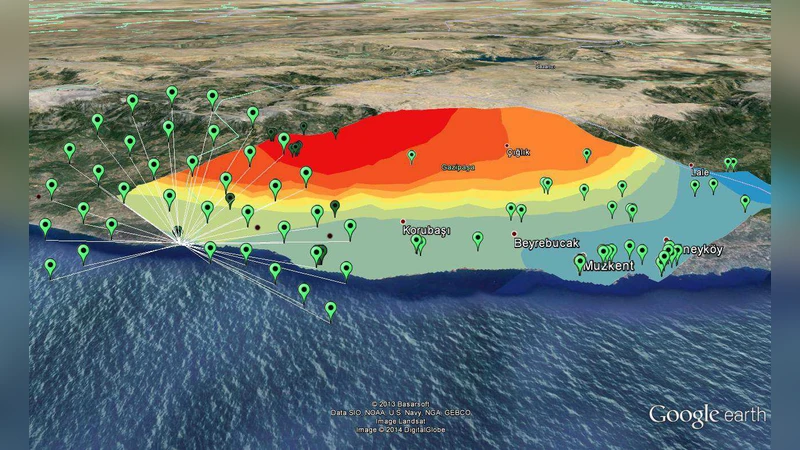
The second strategy focuses on collaborative, map‑based narrative construction. Researchers upload field observations, artifact inventories, and contextual notes to Open Context, where each entry is geotagged. These records are then pulled into Visible Past, where an interactive map built on Leaflet/OpenLayers displays layered data sets. Users can click on any point to reveal a pop‑up containing the associated narrative text, high‑resolution images, 3‑D reconstructions, and even raw measurement tables. A temporal slider lets scholars visualize cultural changes over time, turning static reports into dynamic, spatially aware stories. This approach merges qualitative interpretation with quantitative spatial analysis, offering readers a richer, multimodal understanding of archaeological phenomena.
The third strategy bridges printed scholarship with the digital realm through two‑dimensional barcodes (QR codes). Each map feature and data record receives a unique QR code that is printed alongside traditional text in monographs, field reports, or journal articles. When a reader scans the code with a smartphone, the device resolves the underlying URI and loads the corresponding Open Context entry or the interactive map view in Visible Past. This creates a seamless “hybrid” publication where the printed page serves as a portal to up‑to‑date, richly linked digital content. The authors argue that such linkage not only enhances accessibility but also encourages ongoing engagement, as readers can instantly explore the most recent data, revisions, or supplemental media.
The paper also discusses technical challenges and mitigation measures. Interoperability required careful alignment of data schemas and the adoption of open standards; the authors implemented caching layers and asynchronous request handling to address API rate limits and latency. Long‑term preservation was ensured by releasing all data under a CC‑BY license, maintaining redundant backups, and fostering a community‑driven maintenance model for both platforms.
In conclusion, the Rough Cilicia project demonstrates that a loosely coupled ecosystem, combined with map‑centric collaborative authoring and QR‑code enabled print‑digital integration, can produce a new genre of spatial humanities scholarship. This model delivers transparent, reusable data, integrates narrative interpretation with spatial analytics, and transforms static print into an interactive gateway to the digital archive. The authors suggest that the same framework can be adapted to other domains within ancient history, cultural geography, and anthropology, thereby advancing the standards and scalability of digital humanities publishing.