Commuting Variability by Wage Groups in Baton Rouge 1990-2010
Residential segregation recently has shifted to more class or income-based in the United States, and neighborhoods are undergoing significant changes such as commuting patterns over time. To better understand the commuting inequality across neighborhoods of different income levels, this research analyzes commuting variability (in both distance and time) across wage groups as well as stability over time using the CTPP data 1990-2010 in Baton Rouge. In comparison to previous work, commuting distance is estimated more accurately by Monte Carlo simulation of individual trips to mitigate aggregation error and scale effect. The results based on neighborhoods mean wage rate indicate that commuting behaviors vary across areas of different wage rates and such variability is captured by a convex shape. Affluent neighborhoods tended to commute more but highest-wage neighborhoods retreated for less commuting. This trend remains relatively stable over time despite an overall transportation improvement in general. A complementary analysis based on the distribution of wage groups is conducted to gain more detailed insights and uncovers the lasting poor mobility (e.g., fewer location and transport options) of the lowest-wage workers in 1990-2010.
💡 Research Summary
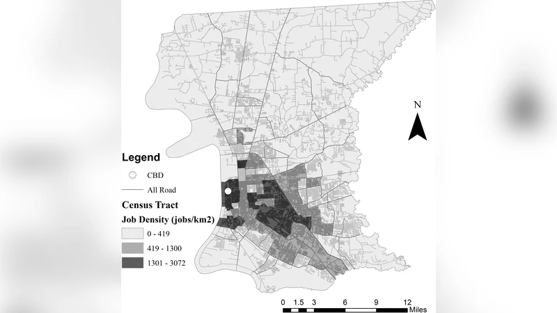
This paper investigates how commuting behavior varies across wage groups in the Baton Rouge metropolitan area over a twenty‑year period (1990‑2010). Using the Census Transportation Planning Package (CTPP) for the three census years, the authors construct a detailed picture of residential workers, jobs, and commuter flows at the census‑tract level (85–91 tracts). Because CTPP does not provide commuting distances, the study advances the Monte Carlo trip‑simulation method originally proposed by Hu and Wang (2015). The new approach integrates land‑use information from the National Land Cover Database (NLCD) and census‑block population data to place simulated residents only in residential land and jobs only in developed (commercial/industrial) land, thereby reducing aggregation bias and the modifiable areal unit problem (MAUP). For each tract, the number of workers and jobs is generated according to the reported frequencies, and random points are drawn within the appropriate land‑use polygons. Network‑based shortest‑path distances are then calculated on the TIGER road network, while average commute times are taken directly from CTPP. By repeating this process thousands of times, the authors obtain robust estimates of average commuting distance and time for each wage group and for each year.
The empirical results reveal a convex (U‑shaped) relationship between a tract’s mean wage rate and its average commuting distance and time. Tracts with low average wages have relatively short commutes, but as wages increase to a middle range (approximately $30–40 k), both distance and time peak. The highest‑wage tracts (> $80 k) show a modest retreat: commuters travel shorter distances and spend less time, a pattern that becomes more pronounced in the 2010 data, possibly reflecting better transportation infrastructure, relocation closer to workplaces, or the rise of telecommuting among affluent workers. This convex pattern is remarkably stable across the three time points; overall commuting times have fallen slightly (about 5 %) due to general transportation improvements, yet the wage‑based disparity persists.
A complementary analysis that examines the distribution of workers across wage categories uncovers persistent mobility constraints for low‑wage workers. Although they travel shorter distances, they rely heavily on public transit, car‑pooling, or walking, leading to higher time‑costs relative to income (exceeding 6 % of earnings). In contrast, middle‑wage commuters experience the longest trips, suggesting that many households in this segment reside in more spatially dispersed suburban locations while working in centralized employment centers.
The authors discuss policy implications: targeted investments in transit service and affordable mobility options are needed in low‑wage neighborhoods to alleviate “mobility poverty.” Moreover, land‑use planning that encourages mixed‑use development could reduce the long commutes of middle‑wage residents. The methodological contribution—Monte Carlo simulation that respects land‑use heterogeneity—demonstrates that reliable distance estimates can be derived from aggregated data, offering a valuable tool for urban planners and transportation modelers where individual‑level travel data are unavailable.
Limitations include the differing sampling designs of the long‑form (1990) and short‑form (2010) CTPP surveys, the need to reconcile tract boundary changes over time, and the absence of actual individual travel routes. Future work could integrate LEHD micro‑data, GPS‑based travel logs, or dynamic traffic models to validate and refine the simulation outputs. Overall, the study provides a nuanced, temporally consistent picture of how income stratification shapes commuting patterns in a medium‑sized American city.
Comments & Academic Discussion
Loading comments...
Leave a Comment