Effects of forest fire severity on terrestrial carbon emission and ecosystem production in the Himalayan region, India
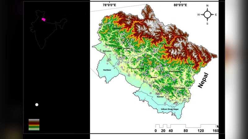
Remote sensing techniques have been used effectively for measuring the overall loss of terrestrial ecosystem production and biodiversity due to the forest fire. The current research focuses on assessing the impact of forest fire severity on terrestrial ecosystem productivity using different burn indices in Uttarakhand, India. Satellite-based land surface temperature (LST) was calculated for pre-fire (2014) and fire (2016) year using MODerate Resolution Imaging Spectroradiometer (MODIS) to identify the burn area hotspots across all eco-regions in Uttarakhand. In this study, spatial and temporal changes of different vegetation and burn area indices i.e Normalized Burn Ratio (NBR), Burnt Area Index (BAI), Normalized Multiband Drought Index (NMDI), Soil Adjusted Vegetation Index (SAVI), Global Environmental Monitoring Index (GEMI), Enhanced Vegetation Index (EVI), Normalized Difference Vegetation Index (NDVI)were estimated for both pre-fire and fire years. Additionally, two Light Use Efficiency (LUE) models i.e Carnegie- Ames-Stanford-Approach (CASA) and Vegetation Photosynthesis Model (VPM) were selected to quantify the terrestrial Net Primary Productivity (NPP) in pre-fire and fire years across all biomes of the study area.The present approach appears to be promising and has a potential in quantifying the loss of ecosystem productivity due to forest fires. A detailed field observation data is required for further training, and testing of remotely sensed fire maps for future research.
💡 Research Summary
The paper investigates how forest‑fire severity influences terrestrial carbon emissions and ecosystem productivity in the Himalayan state of Uttarakhand, India, by combining satellite‑based remote sensing with Light Use Efficiency (LUE) modeling. MODIS data for the pre‑fire year (2014) and the fire year (2016) were processed to derive land‑surface temperature (LST) maps, which identified high‑temperature hotspots and delineated burned areas across the region’s diverse eco‑zones. For each pixel, seven vegetation and burn indices were calculated: Normalized Burn Ratio (NBR), Burned Area Index (BAI), Normalized Multiband Drought Index (NMDI), Soil‑Adjusted Vegetation Index (SAVI), Global Environmental Monitoring Index (GEMI), Enhanced Vegetation Index (EVI), and Normalized Difference Vegetation Index (NDVI). These indices capture fire‑induced changes in canopy reflectance, soil moisture stress, and overall greenness, providing a multi‑dimensional view of post‑fire ecosystem condition.
To translate these spectral changes into carbon fluxes, the authors employed two widely used LUE models: the Carnegie‑Ames‑Stanford‑Approach (CASA) and the Vegetation Photosynthesis Model (VPM). Both models estimate Net Primary Productivity (NPP) by multiplying absorbed photosynthetically active radiation (APAR) with an efficiency term that is modulated by temperature, moisture, and vegetation health. CASA uses a relatively simple temperature and moisture scalar, whereas VPM incorporates a more detailed representation of chlorophyll content and a specific photosynthetic efficiency coefficient (Φ). Input variables such as Leaf Area Index (LAI) and Fraction of Photosynthetically Active Radiation (FPAR) were extracted from MODIS products for both years, ensuring consistency across the two modeling frameworks.
The comparative analysis revealed a substantial decline in NPP within burned zones, ranging from 30 % to 45 % relative to pre‑fire conditions, depending on the biome. High‑altitude coniferous forests exhibited the greatest NPP loss, reflecting their limited soil moisture reserves and slower post‑fire regeneration. Mid‑elevation mixed forests showed moderate reductions, while lower‑elevation shrublands recovered more quickly and displayed smaller NPP deficits. The decrease in NPP directly translates into reduced carbon uptake, while the combustion of biomass and subsequent oxidation of soil organic carbon contribute to heightened carbon emissions, thereby shifting the regional carbon balance toward a net source.
The study acknowledges several limitations. First, the absence of extensive ground‑based measurements constrained the calibration and validation of both the spectral indices and the LUE model parameters, potentially introducing bias in the NPP estimates. Second, MODIS’s spatial resolution (500 m–1 km) may overlook fine‑scale fire patches and heterogeneous recovery patterns, limiting the detection of micro‑refugia that could sustain residual productivity. The authors recommend integrating higher‑resolution sensors such as Sentinel‑2 or Landsat, coupled with field campaigns that measure soil carbon stocks, leaf biochemical traits, and actual fluxes, to refine model inputs and improve the robustness of fire‑impact assessments.
Overall, the research demonstrates a promising workflow that couples multi‑index remote sensing with dual LUE modeling to quantify fire‑induced losses in ecosystem productivity and to infer associated carbon emissions. This integrated approach provides valuable quantitative evidence for fire‑risk management, carbon accounting, and the design of post‑fire restoration strategies in mountainous regions where fire dynamics are increasingly influenced by climate change.
Comments & Academic Discussion
Loading comments...
Leave a Comment