Impacts of transport development on residence choice of renter households: An agent-based evaluation
Because of improving accessibility, transport developments play an important role in residence choice of renter households. In this paper, an agent-based model is developed to investigate impacts of different transport developments on residence choice of renter households in Tehran, the capital of Iran. In the proposed model, renter households are considered as agents who make a multi-objective decision and compete with each other to rent a preferred residential zone. Then, three transport development scenarios including construction a new highway, subway and bus rapid transit (BRT) line are simulated and resulting changes in residence choice of agents are evaluated. Results show that transport development scenarios significantly affect residence choice behavior of different socio-economic categories of renter households and lead to considerable changes in the residential demand, composition of residents, mean income level and mean car ownership in their vicinities.
💡 Research Summary
**
This paper investigates how transport infrastructure developments influence the residential location choices of renter households in Tehran by constructing an agent‑based model (ABM). The authors treat each renter household as an autonomous agent that makes multi‑objective decisions and competes for limited housing capacity. The model consists of three main components: (1) population synthesis, (2) residential option determination using a constrained Non‑Dominated Sorting Genetic Algorithm II (NSGA‑II), and (3) a competition/assignment phase that mimics market competition for rental units.
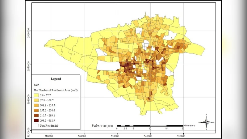
Population synthesis is performed with a Monte‑Carlo approach using zone‑level demographic data and a field survey of 480 renter households. For each synthetic household, attributes such as monthly income, household size, age distribution, car ownership, and required dwelling area are generated. The survey also provides importance scores (0‑9) for twelve residential criteria, including rent level, distance to former residence and workplace, air and noise pollution, accessibility to education, health, cultural facilities, retail, green space, traffic restrictions, and proximity to highways, subway stations, and bus stops.
In the residential‑option stage, each household selects the criteria it deems important and formulates a multi‑objective optimization problem. NSGA‑II is employed to generate a Pareto‑optimal set of candidate zones that simultaneously minimize rent, distances, and pollution while maximizing accessibility measures. The algorithm iteratively creates offspring through crossover and mutation, ranks solutions by non‑domination fronts, and preserves diversity using crowding distance. The resulting candidate set represents the household’s preferred zones before market competition.
The competition phase assigns households to zones based on a rule‑based matching that considers income, car ownership, and a priority score derived from the household’s preferences. This step captures the scarcity of rental units and the competitive dynamics observed in real markets.
Three transport development scenarios are simulated: (1) construction of a new highway, (2) addition of a new subway line, and (3) implementation of a new Bus Rapid Transit (BRT) corridor. For each scenario, the accessibility variables in the objective functions are updated, NSGA‑II is rerun, and the competition phase is repeated to obtain a new spatial distribution of renters.
Results show distinct patterns: the new highway increases residential demand within a 1 km buffer by about 12 % but attracts predominantly low‑income, car‑less households, while higher‑income, multi‑car households tend to relocate away due to heightened noise and air pollution. The subway scenario raises demand around stations by roughly 15 %, lifts the average household income in those neighborhoods by 8 %, and reduces average car ownership by 0.2 vehicles per household. The BRT scenario generates a 9 % demand increase along the corridor, mainly among low‑income renters, leading to a modest decline in average income and a 0.3‑vehicle reduction in car ownership.
The study demonstrates that transport infrastructure can reshape residential markets, alter socio‑economic composition, and affect car ownership patterns. It highlights the importance of integrating transport planning with housing and environmental policies to avoid unintended segregation or increased congestion.
Methodologically, the paper contributes by (a) coupling Monte‑Carlo population synthesis with a multi‑objective evolutionary algorithm to capture heterogeneous household preferences, (b) incorporating a competition mechanism that respects limited housing supply, and (c) applying the framework to a large, data‑rich metropolis. Limitations include sensitivity to NSGA‑II parameters, the absence of social network effects among households, and the focus on a single‑year simulation horizon. Future work is suggested to extend the model to multi‑year dynamics, incorporate additional policy levers (e.g., rent control, subsidies), and validate results with longitudinal housing market data.
Comments & Academic Discussion
Loading comments...
Leave a Comment