Interest of Integrating Spaceborne LiDAR Data to Improve the Estimation of Biomass in High Biomass Forested Areas
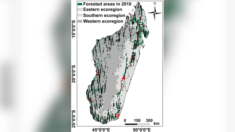
Mapping forest AGB (Above Ground Biomass) is of crucial importance to estimate the carbon emissions associated with tropical deforestation. This study proposes a method to overcome the saturation at high AGB values of existing AGB map (Vieilledent’s AGB map) by using a map of correction factors generated from GLAS (Geoscience Laser Altimeter System) spaceborne LiDAR data. The Vieilledent’s AGB map of Madagascar was established using optical images, with parameters calculated from the SRTM Digital Elevation Model, climatic variables, and field inventories. In the present study, first, GLAS LiDAR data were used to obtain a spatially distributed (GLAS footprints geolocation) estimation of AGB (GLAS AGB) covering Madagascar forested areas, with a density of 0.52 footprint/km 2. Second, the difference between the AGB from the Vieilledent’s AGB map and GLAS AGB at each GLAS footprint location was calculated, and additional spatially distributed correction factors were obtained. Third, an ordinary kriging interpolation was thus performed by taking into account the spatial structure of these additional correction factors to provide a continuous correction factor map. Finally, the existing and the correction factor maps were summed to improve the Vieilledent’s AGB map. The results showed that the integration of GLAS data improves the precision of Vieilledent’s AGB map by approximately 7 t/ha. By integrating GLAS data, the RMSE on AGB estimates decreases from 81 t/ha (R 2 = 0.62) to 74.1 t/ha (R 2 = 0.71). Most importantly, we showed that this approach using LiDAR data avoids underestimating high biomass values (new maximum AGB of 650 t/ha compared to 550 t/ha with the first approach).
💡 Research Summary
The paper addresses a critical limitation in existing satellite‑derived Above‑Ground Biomass (AGB) maps for tropical forests: the saturation of biomass estimates at high AGB values. The authors focus on the Vieilledent AGB map of Madagascar, which was built from optical imagery, SRTM-derived topographic variables, climate layers, and field inventories. Because optical data are primarily sensitive to canopy reflectance and leaf area, they fail to capture the vertical structure that drives biomass in dense forests, leading to systematic underestimation above roughly 400–500 t ha⁻¹.
To overcome this, the study integrates spaceborne LiDAR measurements from the Geoscience Laser Altimeter System (GLAS). GLAS provides waveform parameters (total energy, ground return, waveform length, etc.) for each laser footprint (~70 m diameter). The authors first generate a GLAS‑derived AGB estimate for every GLAS footprint covering Madagascar’s forested areas, achieving a spatial density of 0.52 footprints per km². This step uses a regression model calibrated with field inventory data, linking GLAS waveform metrics to biomass.
Next, at each GLAS footprint location, the difference between the GLAS‑derived AGB and the corresponding value from the Vieilledent map is computed. This difference is defined as a “correction factor” (ΔAGB). The correction factors exhibit spatial autocorrelation: they are positive and large in high‑biomass zones (where the optical map underestimates) and near zero in low‑biomass zones. Because GLAS footprints are sparsely distributed, the authors employ ordinary kriging to interpolate ΔAGB across the entire study area. They first fit an experimental semivariogram, determine that a spherical model best describes the spatial structure, and estimate the range, nugget, and sill parameters. Ordinary kriging then produces a continuous correction‑factor surface (ΔAGB_map) that respects the observed spatial dependence.
Finally, the continuous ΔAGB_map is added pixel‑wise to the original Vieilledent AGB map, yielding a corrected biomass product. Validation against an independent set of field plots and a cross‑validation scheme shows substantial improvements: the root‑mean‑square error (RMSE) drops from 81 t ha⁻¹ (R² = 0.62) to 74.1 t ha⁻¹ (R² = 0.71). More importantly, the maximum estimated AGB increases from 550 t ha⁻¹ to 650 t ha⁻¹, demonstrating that the LiDAR‑based correction successfully lifts the saturation ceiling and captures the true extent of high‑biomass forests.
Key contributions of the work include: (1) a practical framework for integrating sparse spaceborne LiDAR observations with existing optical‑based biomass maps, (2) the use of ordinary kriging to generate a spatially coherent correction surface from pointwise differences, and (3) quantitative evidence that such integration reduces systematic bias and improves overall model performance. The methodology is readily transferable to other regions where GLAS or newer LiDAR missions (e.g., GEDI) are available, offering a pathway to more accurate global carbon accounting.
Future research directions suggested by the authors involve extending the approach to incorporate GEDI’s higher footprint density and full‑waveform capabilities, exploring multi‑sensor data fusion (optical, SAR, LiDAR) to further enhance biomass retrievals, and applying the technique to monitor temporal changes in high‑biomass forests under climate change and deforestation pressures.
Comments & Academic Discussion
Loading comments...
Leave a Comment