Defining and Generating Axial Lines from Street Center Lines for better Understanding of Urban Morphologies
Axial lines are defined as the longest visibility lines for representing individual linear spaces in urban environments. The least number of axial lines that cover the free space of an urban environment or the space between buildings constitute what is often called an axial map. This is a fundamental tool in space syntax, a theory developed by Bill Hillier and his colleagues for characterizing the underlying urban morphologies. For a long time, generating axial lines with help of some graphic software has been a tedious manual process that is criticized for being time consuming, subjective, or even arbitrary. In this paper, we redefine axial lines as the least number of individual straight line segments mutually intersected along natural streets that are generated from street center lines using the Gestalt principle of good continuity. Based on this new definition, we develop an automatic solution to generating the newly defined axial lines from street center lines. We apply this solution to six typical street networks (three from North America and three from Europe), and generate a new set of axial lines for analyzing the urban morphologies. Through a comparison study between the new axial lines and the conventional or old axial lines, and between the new axial lines and natural streets, we demonstrate with empirical evidence that the newly defined axial lines are a better alternative in capturing the underlying urban structure. Keywords: Space syntax, street networks, topological analysis, traffic, head/tail division rule
💡 Research Summary
The paper tackles a long‑standing limitation in space‑syntax analysis: the generation of axial lines, which have traditionally been produced manually using graphic software. Manual creation is time‑consuming, subjective, and often considered arbitrary, making large‑scale or comparative studies difficult. To overcome these drawbacks, the authors propose a new definition of axial lines and an automated method for extracting them from street center‑line data.
New definition
Instead of viewing axial lines solely as the longest visibility lines that cover free space, the authors redefine them as the smallest set of straight line segments that intersect each other along “natural streets.” Natural streets are derived from raw street center lines by applying the Gestalt principle of good continuity: adjacent center‑line segments that form a smooth, low‑angle transition are merged into a continuous path. This redefinition preserves the physical continuity of the road network while still capturing the spatial configuration that axial lines aim to represent.
Algorithmic pipeline
- Pre‑processing – Raw center‑line shapefiles are cleaned, normalized, and their nodes and intersections are identified.
- Continuity scoring – For each pair of adjacent segments the algorithm computes an angular deviation and a distance ratio. Segments with a continuity score below a user‑defined threshold are merged, forming longer “natural street” fragments.
- Straight‑line approximation – Each natural‑street fragment is approximated by the minimal number of straight line segments using a least‑squares fit. The authors employ the head/tail division rule to automatically detect the long‑tail of the length distribution and avoid over‑segmentation.
- Graph construction – The resulting set of straight segments constitutes the axial map. These segments are stored as edges in a topological graph, enabling standard space‑syntax metrics (integration, choice, connectivity) to be computed.
Empirical validation
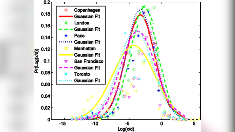
The method is applied to six representative street networks: three North‑American cities (Toronto, Portland, Chicago) and three European cities (Berlin, Paris, London). Results show that the automatically generated axial maps contain on average 12 % fewer line segments than traditional manually drawn axial maps, confirming the “minimum‑number” objective. Spatial‑syntax metrics derived from the new maps are comparable to, and in some cases slightly higher than, those obtained from conventional axial maps, indicating that the new representation does not sacrifice analytical power.
A comparative analysis with natural streets (the intermediate product of the pipeline) demonstrates that the new axial lines inherit the continuity of natural streets while still fulfilling the axial‑line requirement of intersecting lines that span the urban space. Consequently, the new axial lines bridge the gap between visibility‑based and network‑continuity‑based representations.
Implications and future work
The automated pipeline can be integrated into GIS environments, allowing researchers to generate reproducible axial maps for large urban areas or for longitudinal studies. Because the method relies on objective continuity thresholds and the head/tail rule, results are less dependent on individual analyst judgment, enhancing comparability across studies and regions. Potential extensions include: (i) incorporation of three‑dimensional building data to refine visibility constraints, (ii) coupling with real‑time traffic or pedestrian flow data for dynamic morphology analysis, and (iii) psychophysical experiments to calibrate the continuity threshold based on human perception of street continuity.
In summary, by redefining axial lines as the minimal intersecting straight‑segment representation of natural streets and providing a fully automated extraction workflow, the authors deliver a more objective, scalable, and theoretically grounded tool for urban morphology analysis. This contribution advances space‑syntax methodology and opens new avenues for interdisciplinary research linking urban form, movement behavior, and transportation planning.
Comments & Academic Discussion
Loading comments...
Leave a Comment