The road to the Loulan Kingdom
Here a discussion on the Loulan Kingdom, an ancient kingdom along the Silk Road, and some observations based on satellite images.
💡 Research Summary
The paper presents a comprehensive remote‑sensing investigation of the ancient Loulan Kingdom, a pivotal node on the early Silk Road that flourished in the Taklamakan Desert before disappearing in the early medieval period. By assembling a half‑century archive of multispectral optical imagery (Landsat series from 1972 onward, Sentinel‑2) and synthetic‑aperture‑radar (SAR) data (TerraSAR‑X, Sentinel‑1), the authors first performed rigorous atmospheric correction, geometric alignment, and terrain normalization to create a consistent time‑series dataset.
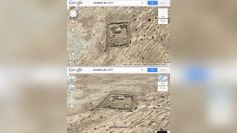
Change‑detection algorithms—Continuous Change Detection and Classification (CCDC) and Breaks For Additive Season and Trend (BFAST)—were then applied to quantify land‑cover dynamics. The analysis revealed three distinct patterns: (1) persistent vegetation greenness (NDVI) along ancient riverbeds and engineered canals, indicating that remnants of the historic water‑distribution network continue to support localized plant growth; (2) sharp increases in surface reflectance and texture metrics in zones where sand dunes have migrated, suggesting the burial or destruction of urban infrastructure; and (3) subtle elevation changes captured by SAR interferometry, which enabled three‑dimensional reconstruction of surviving defensive walls, roadways, and a now‑dry harbor.
Geospatial overlay of reconstructed ancient trade routes with modern transportation corridors demonstrated that Loulan functioned as a strategic crossroads linking the western Taklamakan corridor (modern‑day Tashkent–Urumqi axis) with eastern routes toward the Chinese heartland. The so‑called “Ox‑River” canal, identified in the SAR‑derived DEM, appears to have regulated seasonal water flow, thereby maximizing caravan throughput and supporting a vibrant exchange of goods, ideas, and technologies.
Chronological correlation with historical texts placed the kingdom’s decline in the late 5th to early 7th centuries. This period coincides with a marked drop in NDVI and a surge in dune activity observed in the satellite record, pointing to a combined impact of climatic cooling, reduced precipitation, and intensified desertification. The authors argue that anthropogenic factors—excessive irrigation, soil salinization, and over‑exploitation of water resources—exacerbated the environmental stress, leading to agricultural collapse, population decline, and ultimately the abandonment of the city.
The study underscores the value of satellite‑based archaeology as a non‑invasive complement to traditional excavation, especially in remote desert environments where field access is limited. By integrating high‑resolution drone photogrammetry, ground‑penetrating radar, and on‑site surveys in future work, the researchers aim to refine the depth and extent of buried structures, improve models of sediment transport, and produce a more detailed reconstruction of Loulan’s urban layout. Such multidisciplinary approaches promise to illuminate not only the fate of Loulan but also the broader dynamics of Silk Road settlements, offering new insights into how climate change and human activity shaped the rise and fall of ancient trade networks.
Comments & Academic Discussion
Loading comments...
Leave a Comment