Application of the Earths Natural Electromagnetic Noise to Geophysical Prospecting and Seraching for Oil
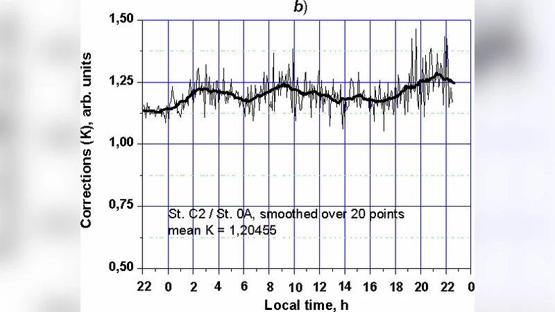
When applying the Earth’s natural pulse electromagnetic fields to geophysical prospecting one should take into account characteristics of their spatial and temporal variations. ENPEMF is known to include both pulses attributed to atmospheric thunderstorms and pulses generated in the lithosphere by mechanic-to-electric energy conversion in rocks. It is evident that the most valuable information on the geophysical structure of a certain area is obviously contained in pulses originated from this area. This article covers a method of recording spatial variations of the Earth’s natural pulse electromagnetic fields which is able to take due account of spatial and temporal variations of EM fields and suits to reveal crustal structural and lithologic heterogeneities including hydrocarbon pools. We use a system of several stations recording the ENPEMF concurrently to erase the temporal variations from ENPEMF records and to sort out the pulses of local and remote origin. Some stations are fixed (reference) and record only temporal variations of EM fields. While the other stations are mobile and measure pulse characteristics related to both spatial and temporal ENPEMF variations along measurement routes crossing the area investigated. Spatial variations of EM fields left after having deleted the temporal variations and pulses generated out of the area investigate show the availability or the lack of geophysical anomalies.
💡 Research Summary
**
The paper proposes a novel approach to geophysical prospecting and hydrocarbon exploration based on the Earth’s natural pulse electromagnetic fields (ENPEMF). ENPEMF consists of two distinct components: atmospheric pulses generated by thunderstorms and lithospheric pulses produced by mechano‑electric conversion within rocks. The authors argue that the lithospheric component carries information about the local geological structure and can therefore be exploited for detecting crustal heterogeneities, including oil and gas reservoirs.
To isolate the locally generated pulses from the overwhelming background of remote atmospheric and global sources, the authors design a multi‑station measurement system. Fixed reference stations are deployed at stable locations to record only the temporal variations of the electromagnetic field (e.g., global ionospheric changes, worldwide thunderstorm activity). Mobile stations travel along predefined survey lines, recording both spatial and temporal variations simultaneously. By synchronizing all stations with GPS‑derived timestamps, the temporal component captured by the reference stations can be subtracted from the mobile‑station records, leaving a residual signal that is presumed to be dominated by locally generated pulses.
The data‑processing workflow comprises four main steps: (1) high‑sensitivity pulse detection (hundreds to thousands of pulses per second), (2) precise time‑stamping and synchronization, (3) differential analysis to remove the common temporal background, and (4) “pulse cleaning” through multi‑station cross‑correlation. Pulses that appear simultaneously (within the timing resolution) at several stations are identified as remote; their arrival‑time differences are used to estimate source distance, allowing the removal of distant contributions. The remaining pulses, which exhibit consistent spatial patterns along the survey line, are interpreted as originating from the investigated area.
Statistical analysis of the recorded data reveals that 80–90 % of all detected pulses are of remote origin, while only a small fraction can be attributed to local sources. Moreover, pulse amplitudes and phases display strong diurnal and seasonal variability, which further degrades the signal‑to‑noise ratio and hampers reproducibility. The authors acknowledge that these characteristics make it difficult to obtain reliable geological information from ENPEMF alone.
To mitigate these limitations, the paper suggests several enhancements: (a) optimizing the geometry and spacing of the station network to improve spatial resolution, (b) employing at least two reference stations to enable multi‑dimensional correlation and more robust background subtraction, (c) applying advanced signal‑processing techniques, including machine‑learning classifiers, to distinguish noise patterns from genuine local pulses, and (d) integrating ENPEMF data with conventional geophysical methods such as seismic, magnetotelluric, and gravity surveys. The authors argue that ENPEMF can serve as a complementary data source, especially for detecting shallow, subtle heterogeneities that may be missed by other techniques.
A major conceptual obstacle highlighted in the paper is the incomplete understanding of the physical mechanisms that generate lithospheric pulses. While mechano‑electric conversion, stress‑induced charge migration, and interactions between the solid Earth and the ionosphere are proposed, quantitative models linking pulse characteristics to rock properties or hydrocarbon saturation are lacking. Consequently, establishing a direct, calibrated relationship between pulse amplitude/phase and subsurface resource content remains an open research problem.
In conclusion, the study demonstrates that ENPEMF‑based prospecting is theoretically feasible but currently limited by low signal strength, high variability, and insufficient mechanistic knowledge. The authors recommend a multi‑sensor, tightly synchronized network, sophisticated noise‑filtering algorithms, and a synergistic workflow that fuses ENPEMF observations with established geophysical datasets. Until these methodological and theoretical gaps are closed, ENPEMF is best viewed as a supplementary tool rather than a standalone solution for oil and gas exploration.
Comments & Academic Discussion
Loading comments...
Leave a Comment