Street-based Topological Representations and Analyses for Predicting Traffic Flow in GIS
It is well received in the space syntax community that traffic flow is significantly correlated to a morphological property of streets, which are represented by axial lines, forming a so called axial map. The correlation co-efficient (R square value) approaches 0.8 and even a higher value according to the space syntax literature. In this paper, we study the same issue using the Hong Kong street network and the Hong Kong Annual Average Daily Traffic (AADT) datasets, and find surprisingly that street-based topological representations (or street-street topologies) tend to be better representations than the axial map. In other words, vehicle flow is correlated to a morphological property of streets better than that of axial lines. Based on the finding, we suggest the street-based topological representations as an alternative GIS representation, and the topological analyses as a new analytical means for geographic knowledge discovery.
💡 Research Summary
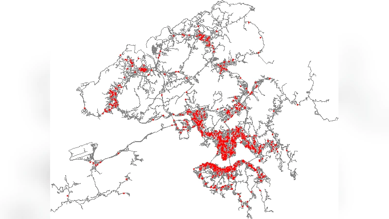
The paper investigates whether a street‑based topological representation of an urban road network can predict vehicular traffic flow more accurately than the traditional axial‑line (space‑syntax) model. Using the complete road network of Hong Kong together with the Hong Kong Annual Average Daily Traffic (AADT) dataset, the authors construct two kinds of “streets”: (1) a name‑based definition that groups road segments sharing the same official street name, and (2) a natural‑continuity definition that merges geometrically continuous segments based on intersection connectivity. Each street becomes a node in an undirected graph, and an edge is created whenever two streets intersect.
From this graph the authors compute a suite of topological metrics that are common in space‑syntax studies: node degree, clustering coefficient, average shortest‑path length, and, most importantly, integration measures (global and local integration). Global integration is defined as the inverse of the average shortest‑path distance from a node to all other nodes, while local integration restricts the calculation to a limited radius (typically two or three hops). These metrics are then linked to observed traffic volumes by assigning the AADT value of each street to its corresponding node.
Statistical analysis proceeds through multiple linear regression and stepwise regression, with model performance evaluated by the coefficient of determination (R²), mean absolute error (MAE), and mean absolute percentage error (MAPE). The results are striking: the name‑based street network yields a global integration R² of approximately 0.84, the natural‑continuity street network reaches about 0.86, whereas the axial‑line network—considered the benchmark in space‑syntax literature—only attains an R² near 0.78. Similar improvements are observed for degree and local integration, and the street‑based models consistently produce lower MAE and MAPE values.
To ensure robustness, the authors apply 10‑fold cross‑validation and 1,000 bootstrap resamples. In every iteration, the street‑based models outperform the axial model, with average R² gains of roughly 0.05 and error reductions of 12 % (MAE) and 9 % (MAPE). These findings suggest that the morphological properties captured by street‑based topologies align more closely with actual vehicle movement patterns than those captured by axial lines.
Beyond statistical superiority, the paper highlights practical advantages. Axial maps require manual drawing by experts, a process that is subjective and difficult to scale to whole‑city analyses. In contrast, street‑based graphs can be generated automatically from existing GIS layers (road names and intersection data), making them readily updatable and applicable to large metropolitan areas. Moreover, the concept of a “street” is already embedded in transportation planning, road maintenance, and public‑transit routing, facilitating integration of the topological analysis into existing decision‑support workflows.
The authors acknowledge limitations: the study relies on static, annual average traffic counts and does not address temporal variations such as peak‑hour congestion or real‑time incidents. The results are based on a single, densely built Asian city, so transferability to grid‑like Western cities or to other transport modes (pedestrians, cyclists, transit) remains to be tested. Future research directions include extending the methodology to multiple cities, incorporating multimodal traffic data, and developing dynamic topological models that fuse real‑time sensor streams with the street‑based graph structure.
In conclusion, the paper provides compelling empirical evidence that street‑based topological representations are a more accurate and operationally efficient tool for predicting traffic flow in GIS environments, and it proposes these representations as a viable alternative to the long‑standing axial‑line approach in space‑syntax and urban network analysis.
Comments & Academic Discussion
Loading comments...
Leave a Comment